Day 39: Karamu farmstay to Pahautea hut

By Elliot

Distance: 14km

Breakfast of eggs, toast and tea was provided by the farmstay this morning. It was all lovely until we got a ten minute warning that the hosts were going to work in 10 minutes, which was 7am. This meant no further access to the toilet beyond that point.

Panic ensued and a queue immediately formed for the toilet. I managed to go before we left, but Ruth wasn’t so lucky. She had to wait until an hour into our walk to use a public toilet. It definitely coloured our stay at Karamu.

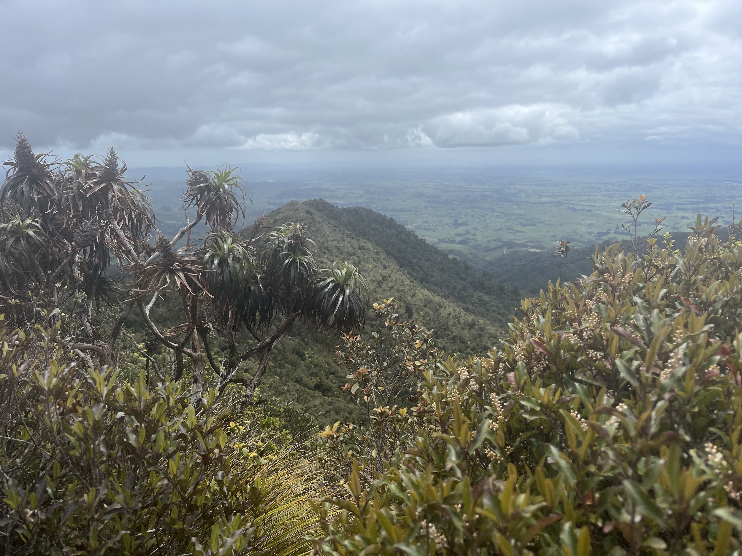
From the toilet, we started walking on a gravel path for an hour, before the track turned steeper and muddy and we started climbing up Mount Pirongia. Something about the forest made it look particularly beautiful today. Maybe it was the moss or that the forest looked prehistoric.

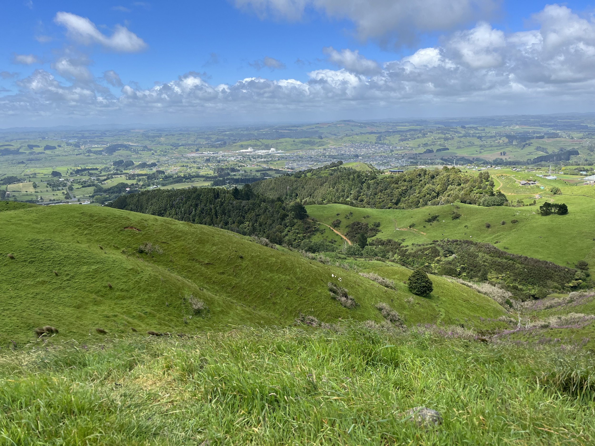
As we kept going up, we started to get glimpses of the farmland below.

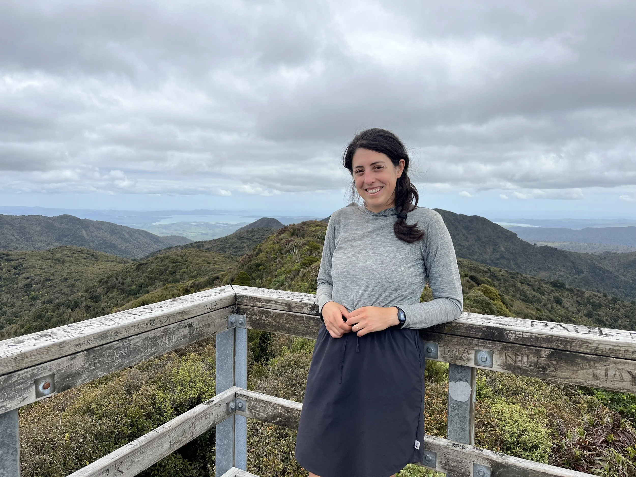
And eventually we reached the summit.

We didn’t find the uphill too strenuous today. The biggest challenge of the day was trying not to get our feet wet by stepping in mud. And while I didn’t totally succeed, my feet stayed mostly dry and Ruth’s new waterproof shoes kept her feet dry.

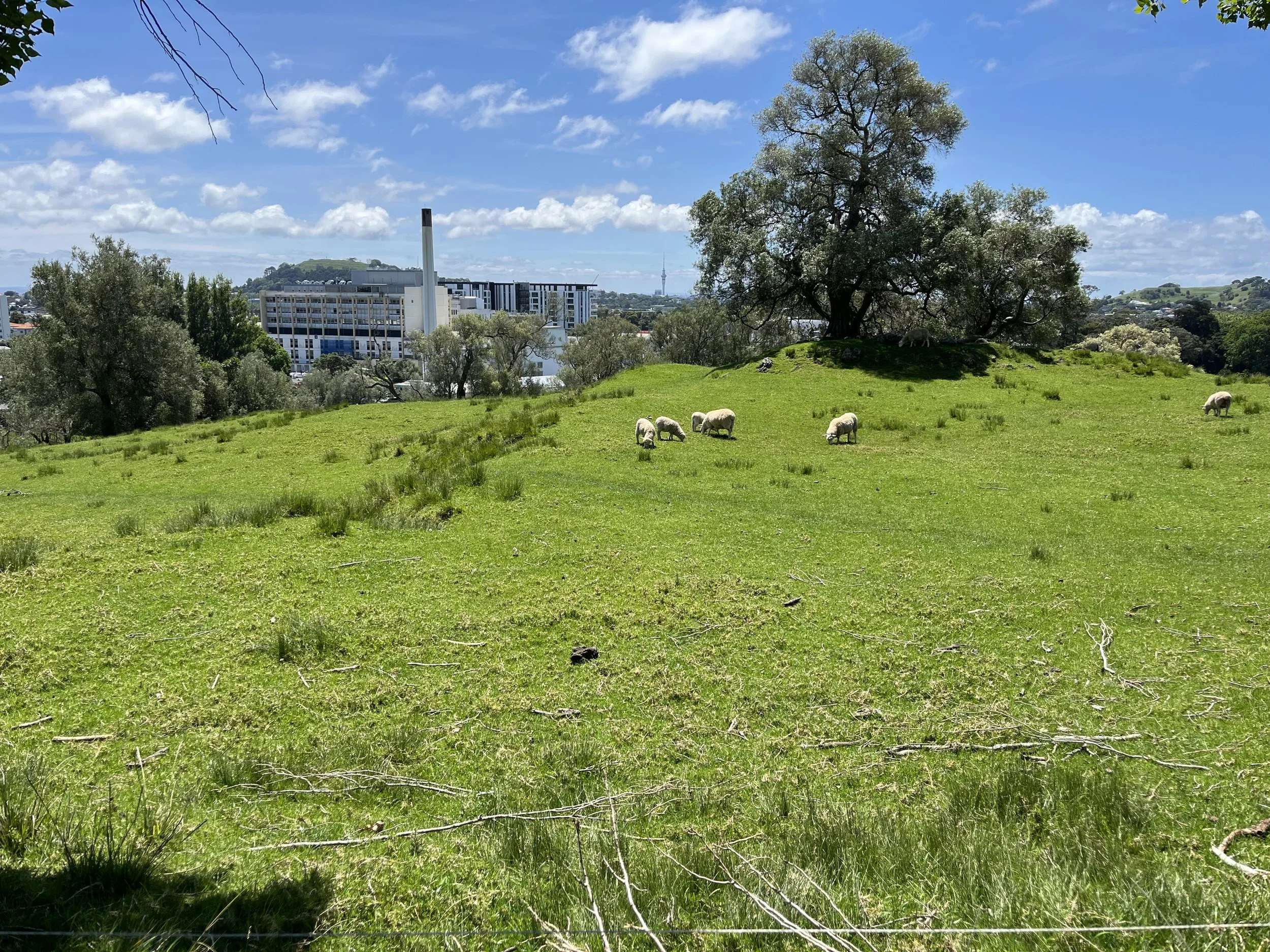
The hut we are staying at tonight was a half hour walk beyond the summit. We got here around 2pm, so we had plenty of time to eat, read and while away the time while gazing upon the farmland below.

Day 38: Hamilton to Karamu Farmstay

By Ruth

Distance: 18 km

After getting treated like the Prince and Princess of Hamilton for the past two nights, I have to admit it was hard to start walking this morning. It didn’t help that the first section of trail was a swampy mess, and our packs were laden down with food for four days. We took our time though and slowly got back into the rhythm of the trail.

After lunch things improved a lot, and we had the most Woolly Wanderers experience yet. The trail took us to a farm track in the mountains, through meadows filled with sheep. At a certain point a farmer came out with a bunch of sheepdogs to move the sheep to a new pasture. For the next half an hour or so we were walking behind a mass of sheep as they were rounded up and herded along the path. They made quite the racket! But it was really cool to see.

Next was a little bit of forest and then we arrived at our camp for the night. There are nine walkers staying tonight! It’s a bit more than the place can handle, but fun to meet a bunch of new people who it looks like we’ll be walking with for the next few days at least.

Day 37: Rest day (Hamilton)

By Elliot

When we were still hiking with Stephen, a topic that came up a few times was trail revelations. You have a lot of time to think while walking, and sometimes you can have a level of insight that you can find profound. For Stephen, I think the biggest revelation was that only by letting go of his desire to slow down and smell the roses would he actually be able to slow down.

My revelation yesterday was to do with what someone else said on the trail: don’t worry, all the problems you left behind by getting on the trail will still be there when you get off the trail. It’s true, but getting a break and some distance from your problems and worries can still be helpful. I don’t know exactly what my next move is career-wise, but for the next few months, I don’t have to worry about that, which is freeing.

Enough pompous philosophizing. Today I got to try the Whittakers peanut slab ice cream.

The Whittaker’s peanut slab consists of milk chocolate and peanuts, which are 35% of the bar by weight. As hungry hikers, the peanut slab is a miracle food. It’s delicious, but also balances the fast sugar from the chocolate with protein and copious amounts of fat from the peanuts. So I was delighted to find out that an ice cream version existed! Since it’s been a few days since my last peanut slab, I thought now would be a good time to try the ice cream. The verdict: mediocre. I will stick to the non ice cream version from now on.

We also went to the Hamilton botanical gardens today, which made the rest day so worth it. It is a veritable theme park of a botanical. There were so many different types of gardens, one next to the other. For lovers of botanical gardens, I think this one would be an international destination. It’s the botanical garden equivalent of a three Michelin starred restaurant.

This evening we had the privilege of cooking for our hosts, which is the least we could do for the level of hospitality and generosity they have shown us.

Tomorrow, it’s back on the trail for us!

Day 36: Ngaruawahia to Hamilton

By Ruth

Distance: 20 km

This morning we had breakfast with Richelle, our trail angel host. We had a delicious homemade granola, and we jokingly asked her where we could buy some, it was so good. When we were going to leave, she packed some up and gave it to us. What generosity!

After the muddy bush track of yesterday, today was basically a walk in the park. Actually, the whole day today was on a walking/cycling path along the Waikato River. It was very scenic, however it is paved the entire way, so although the walking was easy, it ended up being a bit painful on our feet.

Since we were just walking between towns our packs were light and so was the mood.

As it neared lunchtime, however, we made a mistake and decided to take a “shortcut” down Maui Street to get to a cafe for lunch. This turned out to be a super industrial and unpleasant stretch of road, made even worse by our impending hunger. We made it though okay though and then it was back onto the pleasant cycleway for the rest of the day.

There were not many other walkers on the path, but lots of cyclists, most of them on e-bikes which annoyed Elliot greatly. A few cyclists stopped to chat with us, which was very nice. Except when they told us the next nice spot for a break was “just around the corner”, well, apparently that means something different when you’re on foot!

We arrived in Hamilton in the early afternoon and are staying with a trail angel couple who hiked the TA a couple years ago. We met John outside the supermarket in Kerikeri (Day 11!) and he offered us to stay with him when we got to Hamilton. “Sounds great”, we said, but at that point we both had severe doubts that we would ever make it here. But now we’re here! It’s a bit surreal.

What’s more surreal is that when we met John in Kerikeri we also gave him our blog link (hi John & Ali!) so they could follow us along our journey. This evening, at the end of a delicious supper, Ali brought out a beautiful pavlova, because she had read that we missed out on trying it at the craft club in Opuawhanga (Day 17)! It was like the blog had come to life. A true trail angel move.

Today we passed kilometre 750, so we are officially 25% done the trail. Tomorrow is a rest day and re-gear day as the past few days have driven home the fact that my boots are kaput and I need new ones. (Elliot tried to tell me this in Auckland but I was a bit stubborn back then.) So a bit of shopping and a bit of rest are on the agenda for tomorrow.

Day 35: Huntly golf course to Ngaruawahia

By Elliot

Distance: 25km

We woke up at the golf course thinking we had plenty of time to pack up and leave before any of the golfers showed up. How early could golfers show up on a Sunday, anyway? At 7am.

Once there were people around, it felt strange having our tent up and our gear strewn all over a picnic bench, so we hurried to get everything packed up.

There was some potential road walking today that I was hoping we could skip by hitching. Unfortunately, neither of us have much patience to wait around hoping someone will come by and stop for us. So we walked everything.

After 13 km of mostly road walking, we finally arrived at a trailhead. The trail had quite a lot of stairs and some nice trees.

While we were on trail, we got to talking to some people who were coming down the trail. We chatted for a few minutes, and it turns out that one of the people has a sister who lives really close to the trail near Wellington, so we might have found a place to stay for once we get there.

Every post we list the number of kilometres we walked on that day. It’s a fun thing to do, but doesn’t fully capture how long or hard a day was. For example, we walked the first 13km today in 3.5 hours. The remaining 12km took 6.5 hours. Our pace is dictated by how hilly and muddy the trail is. On a flat road, we can go 5km/h. On a muddy trail, we’re lucky if we can get close to 3km/h.

Tonight we are staying at a trail angel’s house. We weren’t sure what to expect, other than that the trail angel was nice, which we heard from someone we met who is now ahead of us on the trail. We get to stay in a bed tonight, instead of camping. And she made us dinner which had plenty of fresh vegetables. Overall, a lovely experience!

Day 34: Mercer to Huntly Golf Club

By Ruth

Distance: 34 km

Today was a long day. A day with several distinct sections of trail. Most of which sucked.

The first section of trail was a hilly forest/farmland track. It looked pleasant but was anything but. It was so muddy and slippery. I was walking very carefully and still managed to slip and fall on several occasions, leaving me shaken and upset. Then, on a flat section with lots of tall reeds, Elliot fell into a thigh-deep hole filled with water.

After the  slippery mud slopes of doom, we entered the razor grass highway. This was a section of trail a few metres from the state highway.  The trail was very overgrown with the type of grass that has sharp edges. Walking through it feels like getting a hundred tiny paper cuts. Not to mention the grass was wet, so our feet were immediately soaked through. Also not to mention the noise from the highway was very hard to ignore.

After that section we walked past an incredibly noisy racetrack . We could hear the sounds of tires screeching for kilometres.

Then, we arrived at the chin-high river reeds, where an incredibly overgrown and somehow also muddy and slippery track followed along the bank of the Waikato River. Each step felt like a 50% chance of sliding down into the river, which we managed to avoid doing through sheer luck. To add insult to injury, right on the other side of an electric fence from the “trail” was a perfectly manicured meadow.

And then, we reached a very scenic section, where we went up and down some small hills on the river bank. The trail here was not overgrown, however it was still uncomfortable to walk on because under the grass the earth was very uneven. My ankles were twisting unpredictably with every step. Then, I saw a small bridge up ahead, not even really a bridge, more like a short section of boardwalk over a ditch. I was so excited to walk on something flat, even if only for a couple of meters, that I hurried towards it. Fatal mistake. As I reached the bridge, I tripped over a clod of dirt hidden under the grass. I can’t remember exactly what happened next, but eyewitnesses say I went flying, doing a somersault over the edge of the bridge down into the ditch below, and kept sliding until I was nearly in the river. Amazingly, I escaped that little incident with nothing more than some shock and a scraped knee.

At that point we had being going for several hours without a break, so after I climbed out of the ditch we decided to stop there for lunch and to recover a bit.

After lunch was a bit of a slog, with some road walking and some walking through cow pastures next to a road, but nothing quite as bad as the earlier sections of the day. We reached Rangiriri around 5pm, and decided to stop there for the night. We walked into town and found the trail angel’s backyard that we were planning to camp in. But it was a pretty unappealing place to stay: really close to the highway and very loud because of that. And there was no shower. So we cooked our dinner there while we thought about the situation. After eating we decided to press on another 9 kilometres to the Huntly Golf Club. It has showers and is on the other side of the river from the highway. Two hours later and we arrived. And yes, we are camping on a golf course tonight.

Overall, today was one of the hardest days on the trail so far (still not as bad as Day 2 though!). Here’s hoping for an easier time tomorrow.

Day 33: Bombay to Mercer

By Elliot

Distance: 22km

We took an early bus this morning to Bombay, south of Auckland. We didn’t want to walk the section of the trail just south of Auckland, as it is all road walking and passes interesting landmarks such as a sewage works.

A few kilometres into our walk, we ran into a few woolly friends.

We proceeded to the top of a hill, where we stopped for a snack and to sing some Lion King.

It was extremely windy, and it rained on and off most of the day.

After coming down from the hill and a short hitch, we were stopped by a man who offered to drive us into Mercer. It was raining fairly hard at the time, and he said that the section of trail we were about to turn off onto was not great. We thanked him, but refused his offer. Had we gone with him, we would have arrived in Mercer before lunch, and then would have had nothing to do for the rest of the day. And we are in New Zealand to walk both the great and not so great parts of the trail (we do still want to avoid excess road walking though).

We are happy we didn’t take his offer. The weather cleared, and the trail, though flat, was pleasant walking.

We also came upon a unique section of trail. It was not well maintained, and we were slowed by all the trees we had to climb over and duck under.

But what made it unique was the combination of the wildness of the trail, and the fact that it ran parallel to a highway.

Tonight we have our tent pitched behind a pub. It is actually much nicer than it sounds, and there was even a place for a hot shower.

Day 32: Auckland Downtown to Onehunga

By Ruth

Distance: 16 km

Today we walked through Auckland on the Coast to Coast Walkway, which goes from the East coast to the West coast of the north island of New Zealand. Luckily in Auckland the island becomes very narrow so this isn’t such a huge distance.

In the morning we left our Airbnb in Ponsonby and went to the budget hotel downtown where we are staying tonight. We left our big packs there and set out on the trail. Although it’s a bit strange to call it a trail when today’s walk was entirely on city streets and through urban parks.

It was a beautiful day. We walked through the University of Auckland, the Auckland Reserve, Mount Eden, stopped for a great lunch and coffee in the Epsom neighborhood, kept going through Cornwall Park, and into Onehunga.

Cornwall Park was one of the highlights of Auckland for us. This big city park has olive trees and a sheep herd! It was so cute to see the sheep munching grass and relaxing in the shade of some beautiful big olive trees. These particular olive trees don’t produce much fruit apparently, but we recently learned that further south there are olive orchards and you can get New Zealand grown olive oil! Something we are very excited to try when we are in that area.

This section of trail was a bit funny because it was obviously trying to take us through as many parks as possible, even if sometimes it didn’t make any sense. For example, this 200 metre detour into a park, past a playground and WWI memorial arch, when we could easily have just continued straight on the road.

As we went further south we got to a more industrial area and eventually reached the west coast. Since we have being doing a few tide crossings lately, we are a bit more aware of the tides. Upon arriving at the water around 2:30pm, we could see the tide was very far out. At first I thought that can’t be right, because I knew high tide yesterday was at 3:15. The tide should have been very high. I was confused for a while before it clicked: we had crossed to the other coast, so the tides were opposite to what we are used to! My mind was blown.

Afterwards we took the train back downtown and went to a tapas bar for a nice dinner. Tomorrow morning we are taking an early bus down to the Bombay Hills to rejoin the trail in earnest. Our stay in Auckland has been great to relax and recover from our minor foot and leg ailments, but it definitely feels like time to start walking again.

Day 30: Rest Day (Auckland)

By Ruth

Today was a rest day but we were very busy with various errands and social engagements.

First I had to take the bus to a neighborhood on the other side of the city to pick up my contact lenses which I had mailed to myself from Paihia (Day 13). Only certain post offices here provide the service of holding your mail for you until you’re ready to pick it up, so I had to send it to the post office in Orakei. I am using daily contact lenses so there are quite a few of them, and it was nice to get NZ Post to carry them here for me.

Afterwards I headed to Newmarket, the neighbourhood with all the outdoors shops. Elliot met me there. I won’t recount every stop we made on this expedition but suffice it to say we visited 5 different shops, some of them multiple times. We bought a few new items but also replaced a bunch of things that had gotten broken or worn out over the course of the last month.

For example, Elliot replaced his shoes with a new pair of the very same shoes. So clean and shiny!

In the afternoon we got together with some friends from the trail to have a goodbye coffee with Stephen and to meet his wife Caroline, about whom we had heard lots over the course of our time together. We first met Stephen in Kaitaia (Day 6)! We will definitely miss our cool trail uncle, even if he sneakily managed to get us to walk more roads than we would have otherwise.

Here are Stephen and Elliot on our last day walking together.

Afterwards we went out for dinner at a vegan Thai restaurant we had really enjoyed on our last stay in Auckland exactly one month ago. It was delicious.

As Elliot wrote yesterday, it is strange being back in Auckland. It feels like our voyage has come full circle, and yet we are not even a fifth of the way through! I hope once we walk out of here on Thursday morning the feeling will start to fade.

Day 29: Stillwater to Auckland

By Elliot

Distance: 31km

We are finally back in Auckland!

We woke up this morning at 5:15am and were walking by 5:45am due to a tide crossing we needed to do. Even at low tide, it was quite deep: I got most of my shorts and underwear soaked through. At least my pack stayed dry!

After the tide crossing and about an additional hour of walking, we were finally back in a population centre. So many people were out walking on the beach.

We stopped at a lovely cafe for breakfast and coffee at around 8am, and then continued. The rest of the day was going from one bay to the next, sometimes on the beach, sometimes on cliff walkways and sometimes through suburbs.

We found that the scenery changes a lot faster in urban environments. On other parts of the trail, you can walk for hours on the same road, with everything blending together. In the city, no more than half an hour would pass before we saw something different : beach, cliffs, suburb, business district, another beach.

Eventually, we made it to the ferry terminal in Devonport. We had been worried about a big downpour predicted for the afternoon. Luckily, we managed to make it to the terminal just in time. It started raining hard, and then pouring once we were on the ferry. It ruined the view of downtown Auckland from the boat, but at least we were dry.

Downtown Auckland was overwhelming. The buildings were immense and the people so numerous. We are no longer used to it. We found the bus to take us to our Airbnb, and felt relief once we were in a quieter neighbourhood.

We are happy that our Airbnb has a washing machine. But it has no place to hang things out to dry. Luckily, we’re engineers.

It feels strange being back in Auckland. In my mind, Auckland was the point we would re-assess our trip and decide if we wanted to continue. Anything shorter would have felt like we didn’t give it a proper try. But then, less than ten days in, we had already decided that we loved it. It also doesn’t hurt that the more beautiful parts of the trail are still to come.

It feels like Auckland is a sort of ending point. It is so big that it feels like the terminal station. Our fellow walker Stephen is ending here, as he was only planning to walk the Northern section. And we’ve been so focused on getting to Auckland that I now feel a bit aimless.

But in a few days, we continue. We will need to find new people to walk with. New connections to forge. More mud to walk in. Exciting times lie ahead!

Day 28: Orewa to Stillwater

By Ruth

Distance: 10km

This morning was very rainy and blustery at Orewa beach. We packed up our tent, the rain and wind making it more difficult than usual. The kite surfers seemed happy with the conditions though!

Today was a fairly short walking day, so we took advantage of it by walking back into the town for breakfast and coffee. We found a really nice cafe where the owner was very friendly and sat down to chat with us for ten/fifteen minutes about our walk and his travels. He and his partner love to travel, often for a year or more at a time. To fund this, they will buy a struggling cafe, work to improve it for two to three years, then sell it and use the profits to take off travelling again.

We lingered for a while over breakfast, because we only had five or so kilometres to walk to Silverdale, where we had our hearts set on having a pie for lunch. Here in NZ, pies are savoury, usually with a meat filling. This one pie bakery in Silverdale, though, is known for its vegan pies! So we thought this was the perfect opportunity for us to experience this cornerstone of Kiwi food culture. We got one vegan and one vegetarian pie. I thought they tasted a bit like a hearty stew encased in pastry. Delicious. Unfortunately the one table at the bakery was in use so we had to use our backpacks as seats while we ate. Didn’t bother us though!

After lunch and a spot of grocery shopping, we headed off to our campsite for the night, the Stillwater Motor Camp. At this point the weather had improved a lot as we walked through some exurbs. We hitched the last 7 km into camp with a very friendly local lady because otherwise we would have been walking on a notorious windy road with no shoulder. We got to Stillwater in the early afternoon and were able to dry out our tent, shoes and socks in the sun.

Later on we walked to the boat club for a beer and chat with some more friendly locals. Then it was dinner and straight to bed, because tomorrow we rise before dawn in order to make a low tide crossing at 6:50 am.

Day 27: Totara Bend to Orewa

By Elliot

Distance: 12km

Breakfast this morning was glorious. I have never known how much of a luxury toast with butter is until today. We took our time packing up and leaving our accommodation, as the place was nice, cosy and indoors, and it was raining.

Finally, we got out and braved the rain. The day started with some uphill. The way the clouds looked over the wet pine forest made me miss Vancouver for a moment.

We saw more evidence of possums. Usually we pass traps that are empty, but sometimes they are full, like today.

We reached an intersection with Puhoi Road, where I wanted to grab a hitch into Puhoi. We’ve been doing a lot of road walking and I decided that enough is enough: I want to avoid aches and pains that road walking often causes.

The intersection was quiet. As I wrung out water from my socks, three cars passed, all going the wrong way. As I took a sip of water and prepared to start walking the road in defeat, a pickup truck came going the right way. And he stopped for us.

But instead of just giving us a ride halfway to where we wanted to end up today, which is what we were planning, he convinced us that he should drive us all the way there. So we were in Orewa before 1pm, which was perfect time for lunch.

We were at the holiday park before 3pm. Unfortunately, the holiday park isn’t great. The weather is grey and rainy, which would make anywhere you pitch your tent less than ideal. But it’s also next to a loud, busy road, and the campground itself is busy with lots of RVs since it’s a Saturday. The indoor spaces have a strange antiseptic smell, so it’s not great in there either.

One of the good parts of today is that I cleaned my socks. Since my shoes and socks were soaked today, there was no reason not to wash my socks. Instead of having dirty wet socks to wear tomorrow, I will have clean wet socks!

Day 26: Camp 485 to Totara Bend

By Ruth

Distance: 23 km

This morning we woke up a bit early. We didn’t sleep that amazingly because the ground wasn’t too flat at Camp 485. On the plus side we saw this gorgeous sunrise, and got our earliest start yet - 7:20 am.

Today’s walk began in a nice forest with some easy river crossings. Afterwards we got into an active logging area. It was a bit shocking to see the contrast of one side of the road (the forest we had just walked out of), and the other side, where it was clearcut.

After this rude exposure to the forestry industry, we entered the Dome Forest. We had heard a lot of whispers about the Dome Forest, and how muddy and difficult the walking there is. Luckily, we have been having pretty nice and dry weather recently, and although the trail was muddy, it wasn’t bad at all. It was a very enjoyable section of forest walking.

So far I’ve noticed two big differences between the tramping we’ve done in NZ so far and the hikes we generally do in BC. One is the mud. I don’t know much about geology, but the soil here doesn’t seem to absorb much water. In BC when it rains the ground will pretty quickly soak up all the water, not leaving many puddles on the forest floor. But here the soil is like clay. Once it gets wet, the water will just sit on the surface forever, leading to lots and lots of mud.

The second thing is elevation profiles. In BC we usually hike up a mountain. The elevation profile is very simple: up and then down. Here we tend to walk either on the beach (flat) or on forest ridges which go up and down repeatedly. It is a different rhythm from what we are used to.

At the end of today we walked through some sheep pastures and on some roads before arriving at our hosts for the night – Roma and Graham’s place. We have pitched our tent on their lawn and have use of a whole little cabin with a kitchen stocked with bread, jam, milk, and frozen veggies. A real luxury stay.

Day 25: Pakiri to Camp 485

By Elliot

Distance: 14km

Given the short day, we were in no rush to leave the holiday park this morning, which made it surprising that we left around the same time as usual: 8:30am.

Before we started this trip, we were very excited to see sheep. We have seen sheep, including today. But we’ve probably seen more cows than sheep. We’ve learned that the South Island is where the sheep concentration is really high. One more thing to look forward to on the South Island!

After a little bit of flat walking, we started climbing up a hill, and getting farther from the ocean.

While it hasn’t rained much in the last couple of weeks, there were still some sections of trail that were quite muddy. Our pace was slowed by trying to not get our feet soaked in mud. I was unsuccessful and with a small slip got one of my feet completely covered.

At lunchtime, as we sat around on a helicopter pad, a group of 18 older women popped out of the forest along the trail. This was the second hiking club we’ve encountered in the last week. It’s a nice run-in: as a Te Araroa hiker you feel like a celebrity. All the ladies want to know where you’re from, how far you’re going, how you are finding the trail. I feel like an ambassador for the trail when I chat to these ladies and others who ask about what all this walking is about. I want them to have a good impression of through-hikers, so that the people who live in the places we are going through continue to host us with pleasure.

Later in the day, as our spirits sagged due to a very steep, very muddy section, we rounded a corner and came upon some trail magic.

The refreshments were just enough to get us into camp at kilometre 485 on the trail.

Day 24: Mangawhai to Pakiri

By Ruth

Distance: 21 km

Today we left the magical seaside town of Mangawhai. We couldn’t leave too early though because at the end of today’s walk was a tidal river crossing, which should be done around low tide. Low tide today was around 3:15 pm. We didn’t want to arrive at the river too early and have to sit around waiting for the tide to go out. So we got a leisurely start walking around 9:45.

The first hour or so of walking was not great. We were on a mostly gravel road, which at least is better than paved, but this one had lots of traffic and was not very scenic. And to top it off there was some kind of chainsaw noise that we could hear for a long time. The best part of the road was this sign, whose meaning is a mystery but at least it was unique.

Luckily that was the shortest segment of the day. After that we arrived at the beach, whose dunes are the nesting ground for the endangered New Zealand fairy tern (a type of bird). We did not see any of these, but plenty of seagulls, oyster catchers, and sand pipers.

The beach lasted the whole rest of the day. It was pretty but a bit long and repetitive by the end, as beach walks tend to be. We arrived at the tidal river right on time, around 3:30. We got to our holiday park for the night a little bit after that, and I had a hard time finding a place to hang my socks up to dry (they had gotten a bit damp on the beach). Luckily Elliot suggested this little nook.

Tomorrow we leave the coast for a few days and head into the forest. I’m looking forward to the change of scenery!

Day 23: Mangawhai Heads to Mangawhai

By Elliot

Distance: 7km

Today was supposed to be a rest day. But while we were walking yesterday, I hatched a plan. To shorten our next planned walking day, we could lazily make our way from the holiday park on one side of of Mangawhai, to the one on the other.

We started with a walk to a nice cafe for breakfast. We had coffee, I had shakshuka and Ruth had some kind of savoury plate with avocado and other good stuff. Unfortunately, I remembered to photograph too late, so I can only show the table.

We spent about 2.5 hours over breakfast planning the next section of trail, all the way to Auckland.

From the cafe we made our way to the supermarket, to re-supply for the next 4 days. We had to buy another tube of sunscreen, even though we bought the last one 10 days ago. Usually, one tube of sunscreen lasts us months!

Once we’d finished shopping groceries, it was lunch time. So we kept walking. Half an hour later, we were at a different café.

We had lunch , which included a chocolate cheesecake for dessert. From there, we walked 15 minutes to our campsite for the night. Overall, a great day!

I want to expand a bit on our planning. In general, every few days we need to figure out the next few days of trail. We need to know where we can resupply, which up until now has been the driving factor for how many days we need to plan for. We also need to know the potential places we can stay on the trail, and then figure out the distance we generally want to walk. If two places to stay are close together, we might want to skip over a spot to make our days longer.

The trail has an app with trail notes that sometimes list accommodations in the trail description and sometimes in the middle of the trail directions. So we do a close reading of the text, try to extract all the relevant information and then try to shape several days of walking of a length that we are happy with that doesn’t also mean we have to carry many days of food. It’s a bit of a puzzle, which confounded me at first, but I’ve grown to like doing it. And the great thing is that the rest of the time, the planning had been done and I can just enjoy. Our big trip is being divided into many mini-trips.

Anyways, tomorrow we don’t need to plan again until Auckland: we can just enjoy.

Please enjoy this picture of this morning’s sunrise over our campground.

Day 22: Waipu Cove to Mangawhai Heads

By Ruth

Distance: 24 km

Today’s walk included two separate DOC trails: the Brynderwyn Walkway and the Mangawhai Cliffs Walkway. In between we walked some roads and through some farm pastures to link up the two trails. This is somewhat emblematic of a lot of the walking we’ve done so far in the Northlands – some gorgeous walking tracks linked together by farms and roads.

The beginning of the day was the road walk. It was a pretty nice road walk because it was gravel (easier on the feet than asphalt) and had some excellent views. The drawback was that today was a sunny warm day, and there was no shade.

Since we are now less than a 2 hours’ drive from Auckland, we are walking through a lot of places that are almost entirely filled with holiday homes (called “baches” in the vernacular). Along the road there were huge parcels of land for sale, to develop your dream bach.

At the end of road we turned onto the Brynderwyn Walkway, a forest trail. It went up and down and up and down along a ridge until the highest point where there is an informal campsite for TA walkers. We stopped there for a big mid-morning snack. While we were sitting at the picnic table, a group of about a dozen older ladies arrived. They were a hiking club from Mangawhai, out for a day hike. They knew all about the TA and were so excited to meet us. They gave us some tips for the rest of the trail to avoid some road walking, and also of places to go out for coffee in Mangawhai.

After we emerged from the forest, we had to walk through quite a bit of farmland. Although lovely, it was now around midday, and there was no shade for hours. I was starting to think we should have stayed at the informal campsite for a nap and continued walking later in the day.

But everything became worthwhile when we reached the Mangawhai Cliffs trail, which was an absolutely stunning walk high above the shoreline. The water here is an incredible colour.

At the end of that trail we got down to the beach and I went for a quick swim. It was so nice.

Tonight we are staying in Mangawhai Heads and tomorrow we are going to walk to the actual village of Mangawhai, only a few kilometres away. So basically tomorrow is a rest day. To take advantage of our relaxed schedule now that we’re here, we went out for dinner (with Stephen) and had pizza and beer.

Day 21: Whangarei Heads to Waipu Cove

By Elliot

Distance: 30km

The day started with an 8am boat ride across the heads. The other hikers and us were all looking out at the water, trying to see where the water taxi would come from.

The answer: it arrived on the road, pulled by a tractor. Once in the water we zipped across in ten minutes.

On the other side we walked on the beach for a while.

There was a tidal crossing we were supposed to do, but we were there at high tide, so crossing wasn’t possible. Instead we went around and along a bridge, which added a few kilometres to our day, and about an additional hour of road walking.

We eventually made it back onto to beach, but not before stopping for coffee and cake at a cafe.

It was interesting to see people out enjoying their Sunday at the beach, doing something normal and not trying to walk across a country. When I saw all those people, the thought popped into my head that they don’t have sore feet.

We got into Waipu not too late, where we bought some additional items for dinner. Then it was another 8 or 9 kilometres to the cove, often on roads.

I think we need to get better at deciding when to hitch a ride. There were ten-ish kilometres today of road walking that weren’t particularly enjoyable and that I think would’ve been easy to catch a ride on. But right now our default is not hitching, so I think we need to overcome a certain level of inertia. We also don’t have clear criteria for what we should hitch. I think we will figure it out in due time.

Day 20: Ocean Beach to Whangarei Heads

By Ruth

Distance: 13km

We woke up early as usual this morning and enjoyed a relaxing morning coffee on the terrace before a hot breakfast of eggs, beans, avocado and toast.

Afterwards the luxury continued, as one of the services offered by our hosts was to leave our big packs with them for the day, and do today’s walk with just a daypack. Today we walked the gorgeous but challenging Te Whara track which follows a distinctive ridge along the cape of the peninsula. Here is a view of the Te Whara ridge from yesterday’s beach:

And here is the view from the top of the ridge.

Two happy hikers.

We were extra happy to be doing the hike with just our daypacks, although we did feel a little bad when we passed our fellow TA walkers with their big packs on the trail. To make up for it we did a little extra loop at the end of the ridge.

After the hike, Melissa, one of our hosts from last night, came to bring us our bags, and also drove us a few minutes down the road so we could skip a few kilometres of road walking. We asked her to drop us at a cafe near the campsite where we enjoyed a coffee and brownie, before walking into camp.

After yesterday’s plush comforts I was a bit worried it would be hard to go back to camping, especially since tonight’s camping spot is pretty rudimentary, without even cold showers. But it’s a beautiful location, we have the company of our fellow walkers, and we saw a beautiful sunset. So it wasn’t so hard after all.