Day 102: Devil’s Den Bivvy to Cannibal Gorge Hut

By Ruth

Distance: still not sure

We awoke this morning in our little hut high up on a mountain saddle. A beautiful pink sunrise lit up the valley below. It had gotten pretty cold during the night so I was zipped all the way up in my sleeping bag. Even though the wind was loud, the mattresses were paper-thin, and we were pretty sure we could hear a mouse in the wall, it was one of the coziest and best hut experiences we’ve had.

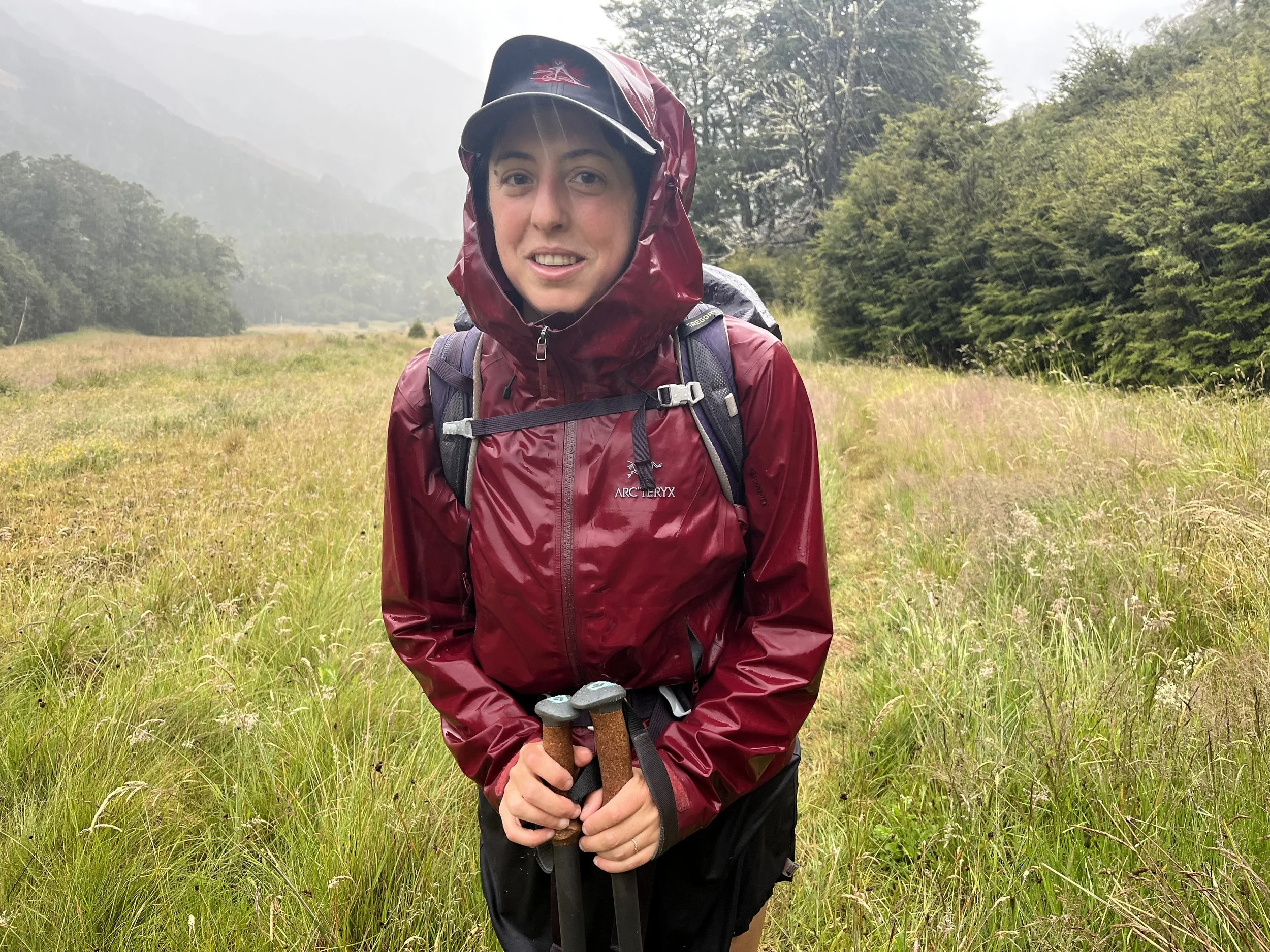
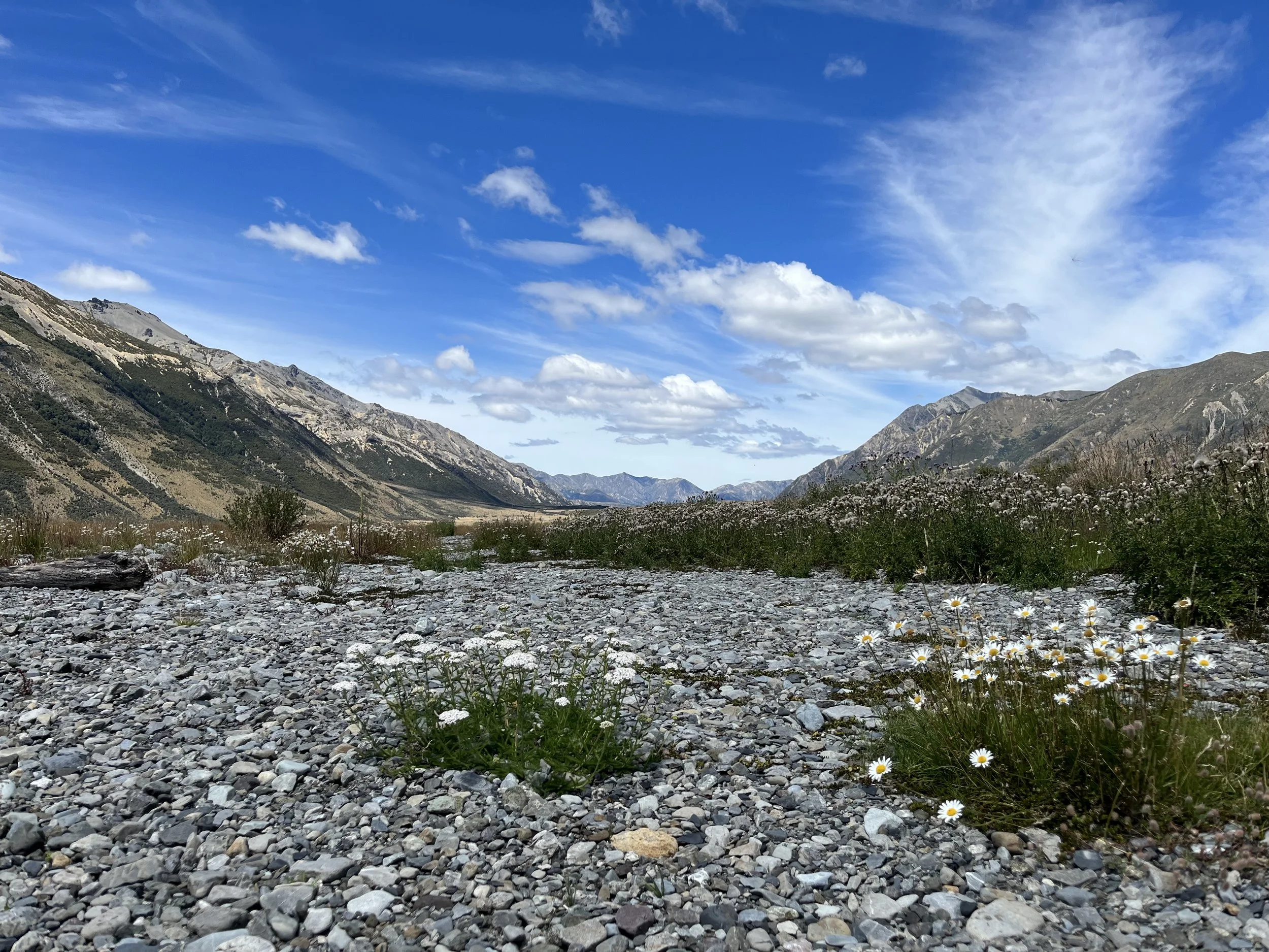
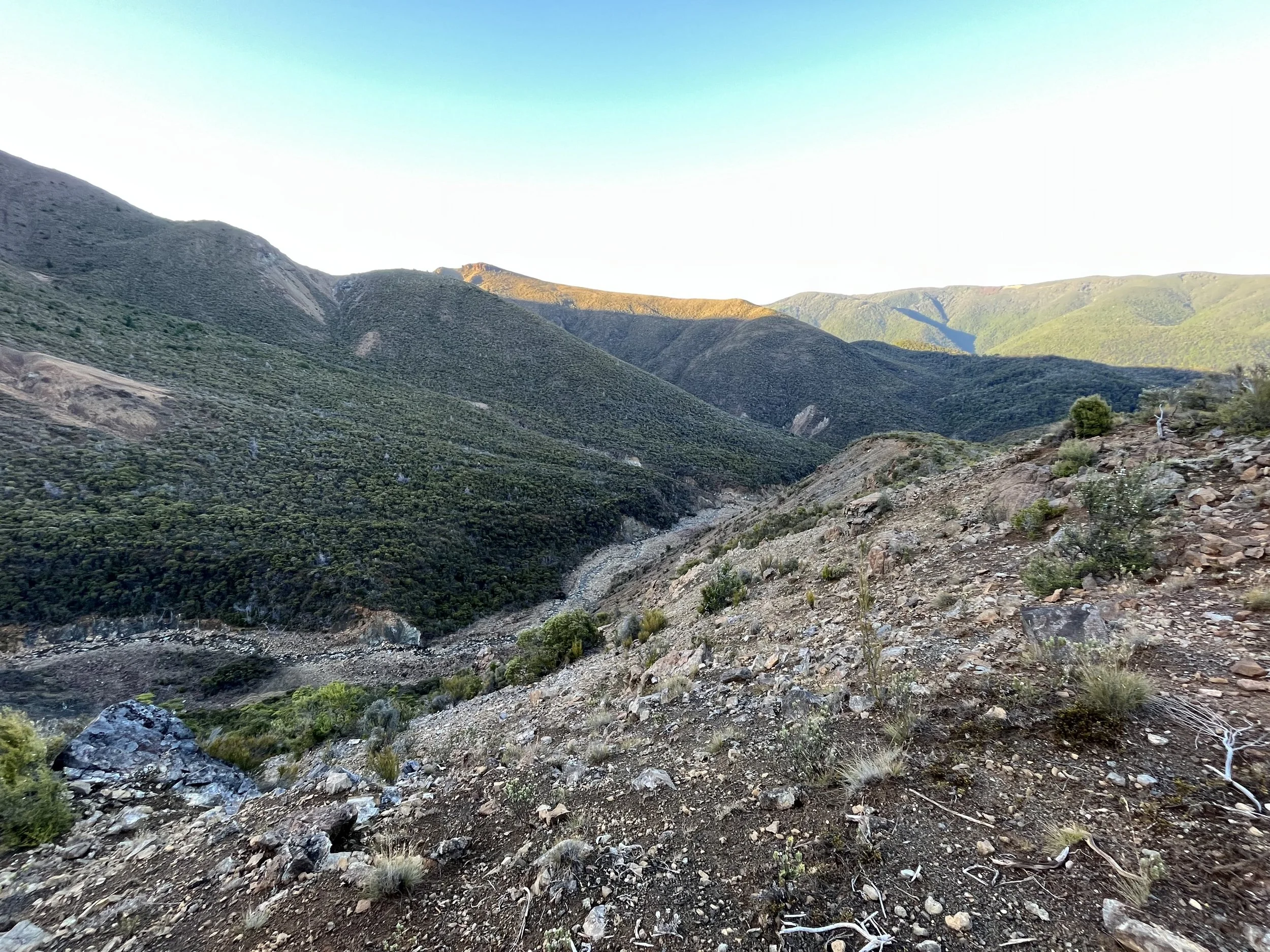
Maybe because of that, it took us a while to get going this morning, and we had a late start at 7:45 am. We had known that the Sylvia Tops route would not be a well-defined trail, or even marked for a lot of it, but we thought that once we reached the bivvy, we would be back on a normal trail. Not so. It turns out the way down to the Doubtful River valley was classified as “route“ as well, meaning above the bush line, it was straight bush whacking, similar to yesterday’s battle with the grasses. Then, once we were in the trees, the way was marked but the trail super overgrown, blocked by fallen trees, steep, and hard to follow. It was slow going down into the valley; tiring and frustrating.

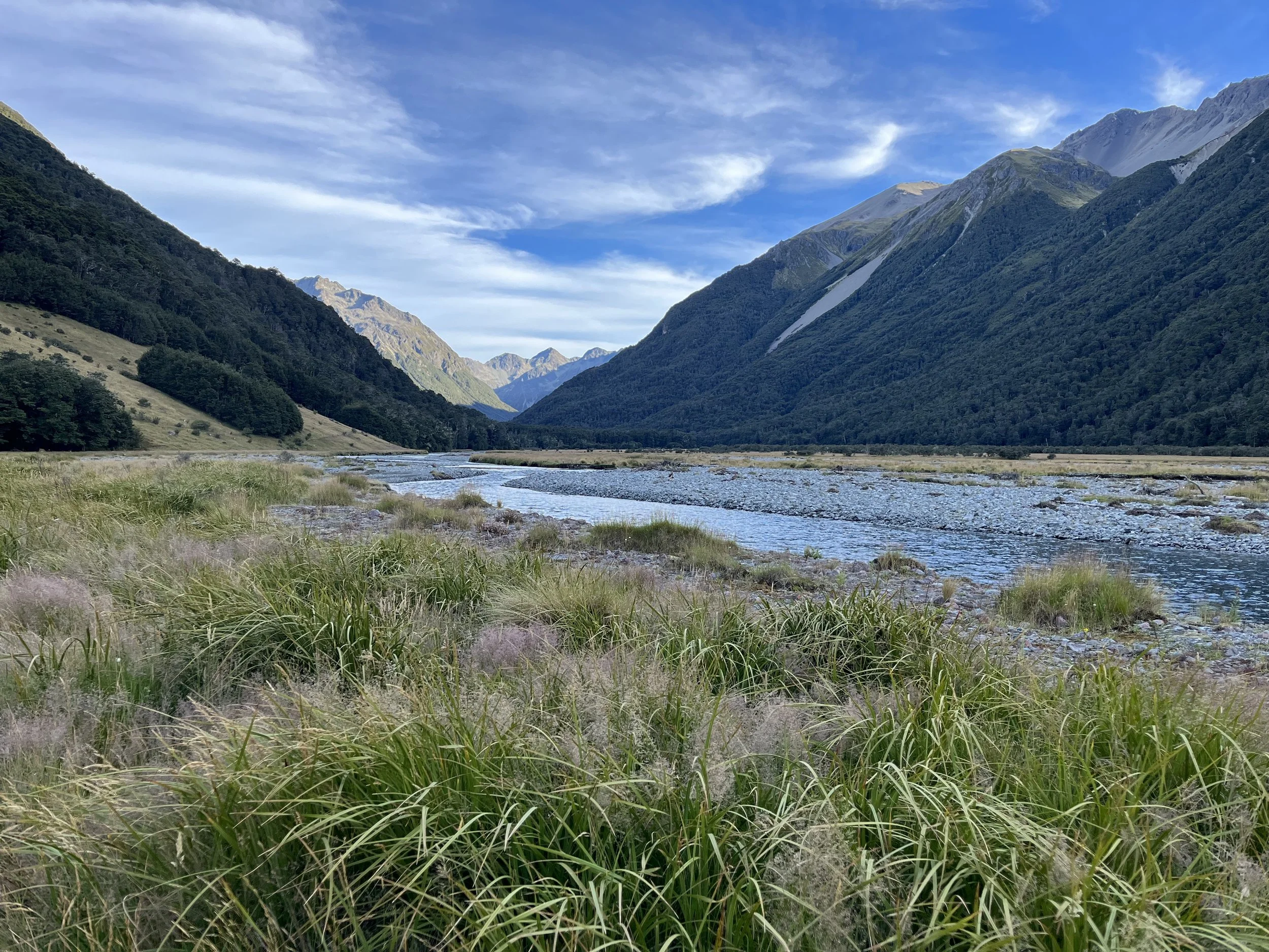
When we finally reached the Doubtful River and the little hut there, we stopped for a quick lunch (the sand flies also got some lunch, courtesy of our ankles), then started walking along the river, relieved to finally be on a real trail. Things went a lot quicker from then. Although, the trail was still overgrown in places and the bushes felt very unpleasant brushing against our legs which were raw from the stabby and slicey grasses we had to deal with earlier.

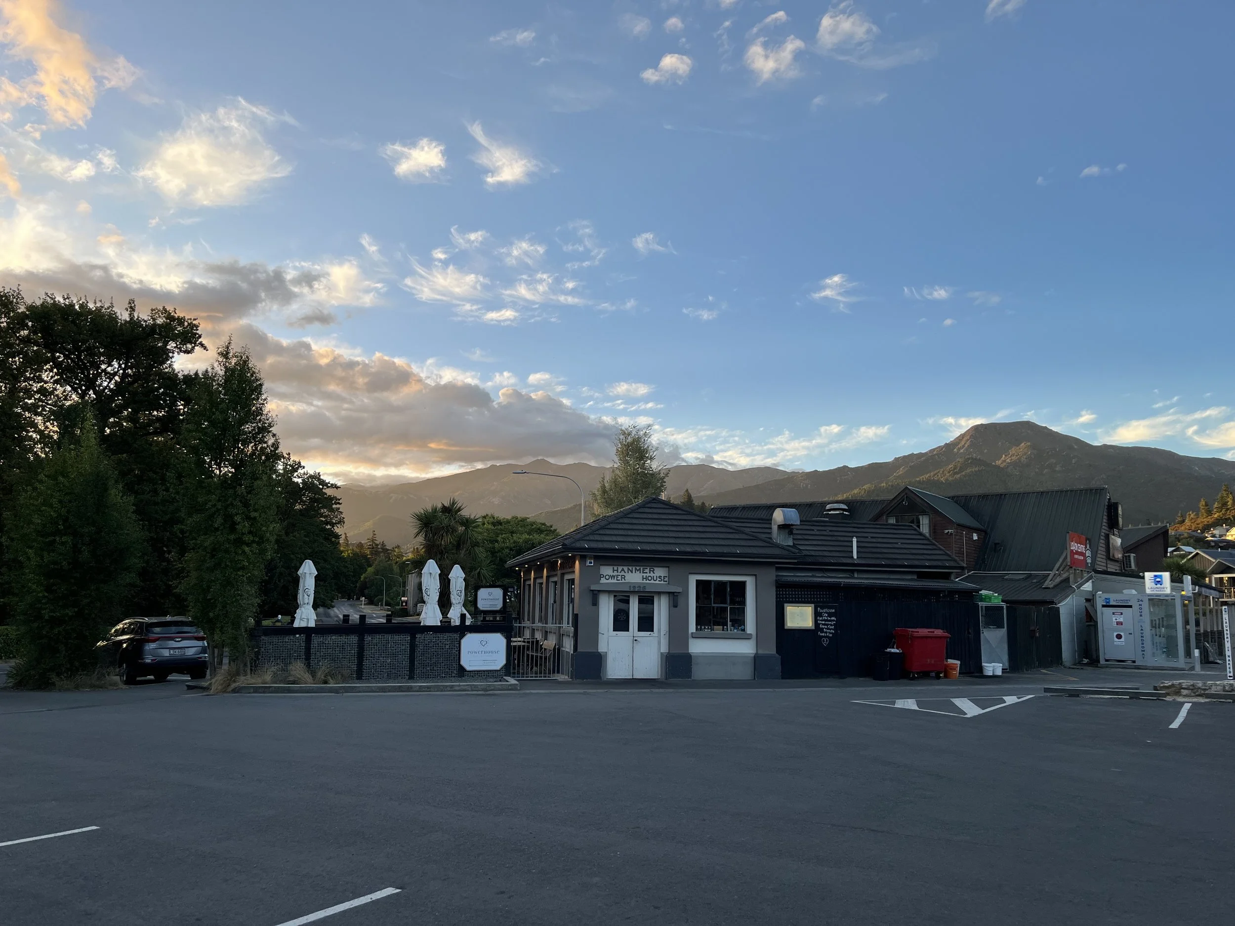
We were a bit worried about having enough time to execute our original plan, which involved getting to the highway at Boyle Village and then walking another 4 hours to Boyle Flat hut on the St James Walkway. Indeed, when we reached the highway, we realized we would not have time to get to the hut before dinner.

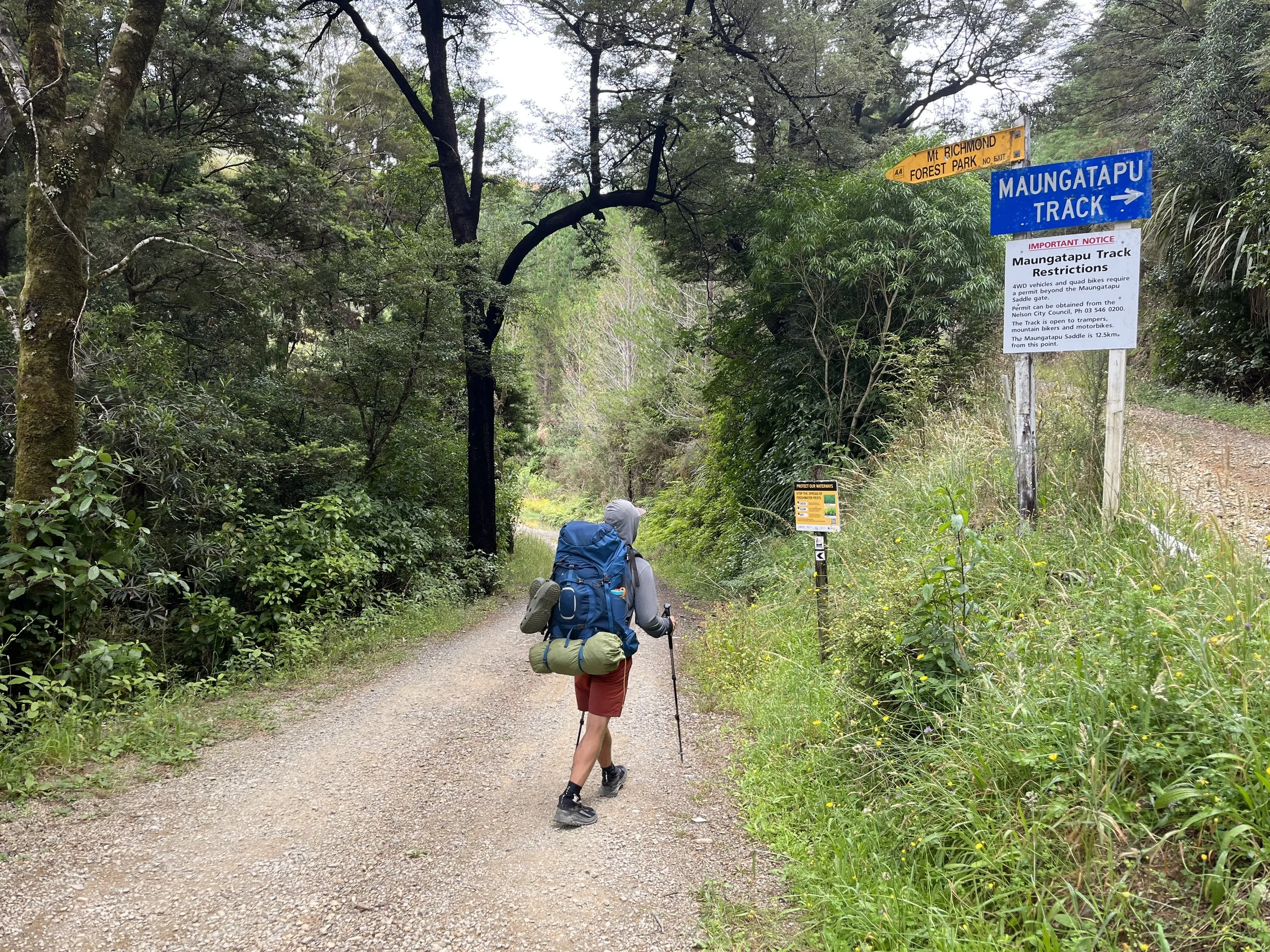
So we modified our plan on the fly, and decided to hitch to the other end of the St James Walkway and do the walk in the other direction. In that direction, there’s a hut less than 3 hours along the trail. It’s a bit of a novelty to make these executive decisions for ourselves after so long of just following the trail notes!

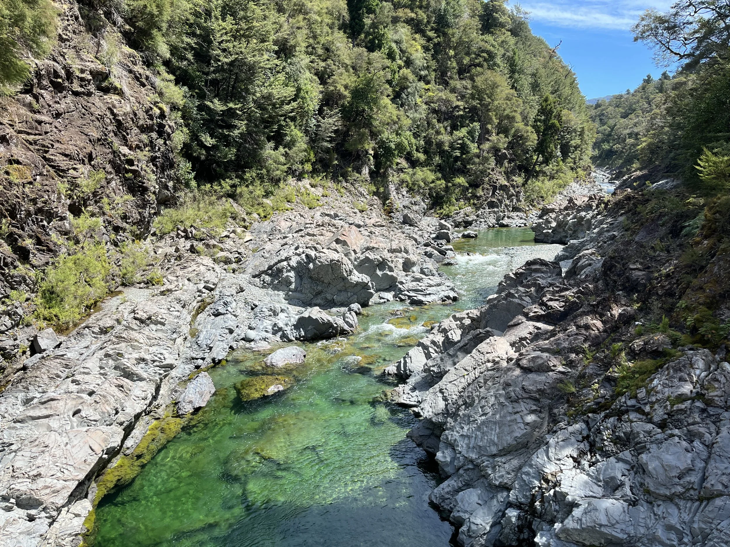
So we forded the Boyle River to reach the side of the highway (and took a dip, of course! The cool water was very soothing on our poor legs). Time was still a bit tight for plan B, so we gave ourselves 10 minutes to get a ride to the other trailhead. After that, we would switch to the other side of the road, and try get a hitch to Christchurch. (It wasn’t just the timing problem that made that option appealing. For one, the Sylvia Tops loop was a lot tougher than we expected. There is also the heavy rain supposed to start tomorrow. And, the last two days seem to have destroyed my shoes which are now riddled with holes.)

Anyway, we waited for 9 minutes on the side of the road before a car which had passed us at minute 6 or 7 came back down the other side of the road, executed a beautiful u-turn, and stopped to pick us up. It turns out the driver (a German DJ on his way to perform at a music festival) thought he had too much gear in his car for us to fit, but then realized that actually maybe we would be able to. And we were, comfortably! Needless to say we were very grateful he turned around to pick us up.

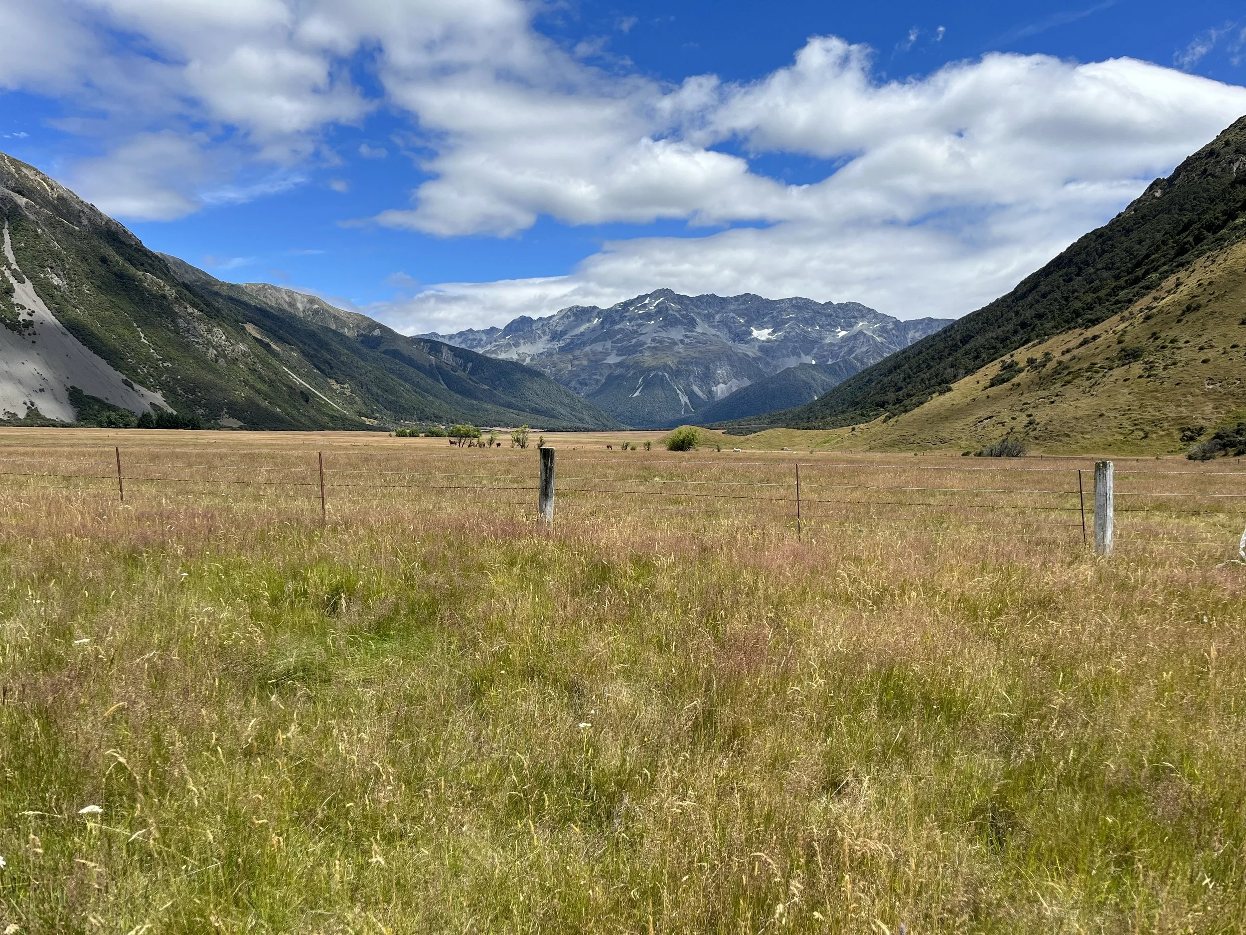
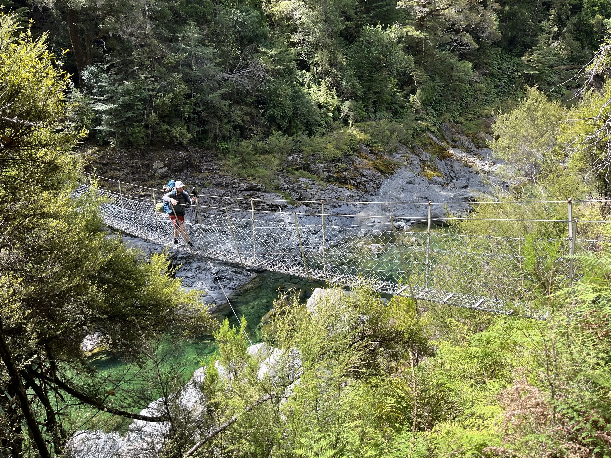
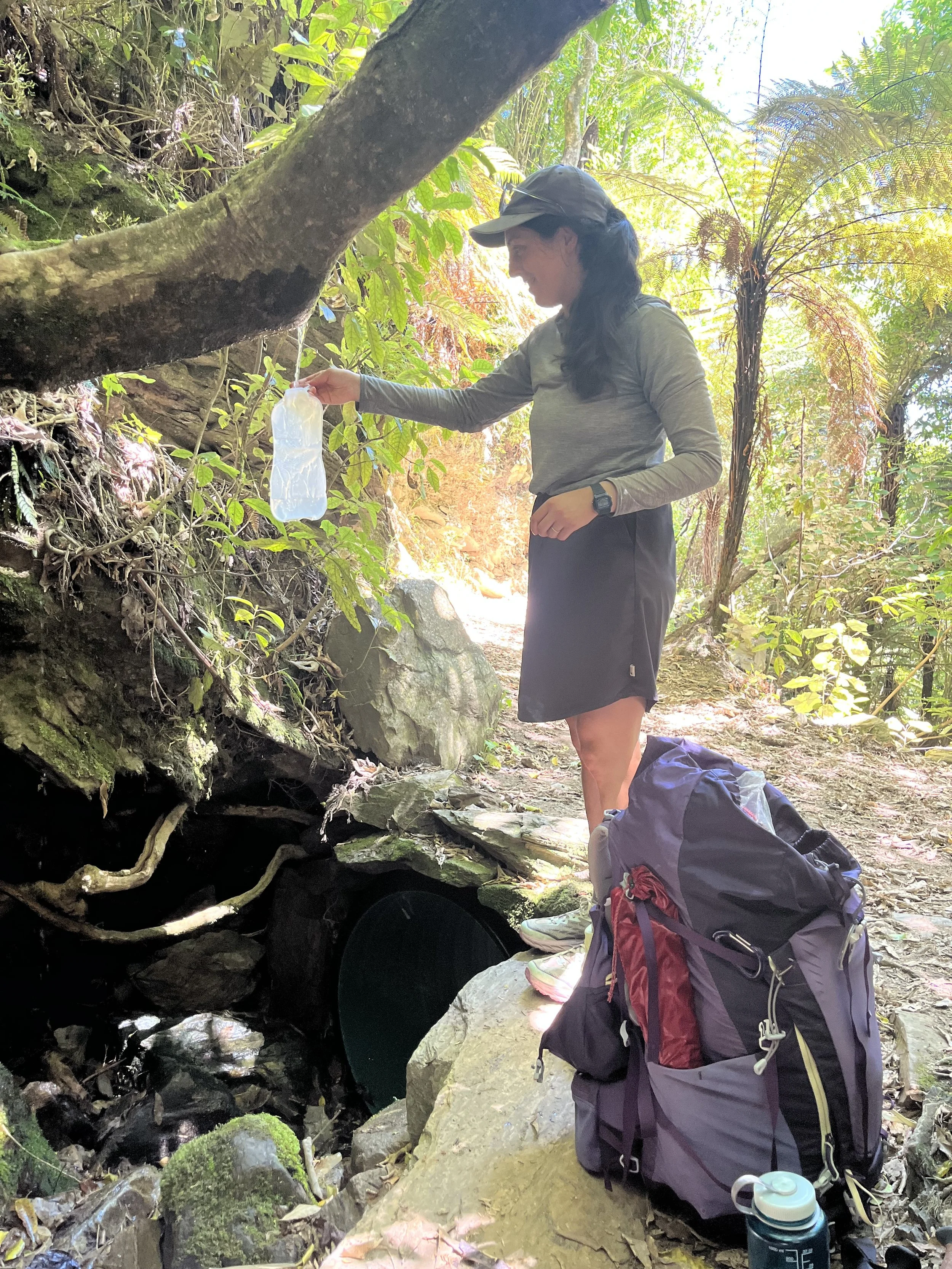
The drive was about 15 minutes, and then we were at the other end of the St James Walkway. Now this was a trail. Beautifully maintained, wide, switchbacks for the steep bits, bridges over the rivers, and even boardwalks for the swampy parts. We really enjoyed the walking, but eventually the fact that we had been going for nearly ten hours caught up with us and we both started getting pretty tired. But a couple breaks, snacks, and some fresh water from a mountain stream helped us make it to Cannibal Gorge hut where we’re sleeping tonight. It’s a bit of a contrast to last night’s hut, as it has 20 bunks! But we again have the whole place to ourselves. We had a great evening with another dip in the river before dinner and bed. As we headed to bed it started raining so it’s shaping up be a cozy night after another challenging day on the trail.

Day 101: SH7 to Devil’s Den Bivvy

By Ruth

Distance: ??

We woke up from our fourth and final night at the motel in Hanmer Springs, sad to be leaving behind the luxury, but looking forward to being on a new trail – one of our own choosing! We went out for one last flat white before getting our thumbs out for the hitch back to Boyle Village (actually a few kilometres beyond Boyle along the highway).

The hitch was a bit of an adventure on its own, as first we got a short ride out of Hanmer to the highway junction, and then got picked up from there by a couple who are modern-day gold diggers out near Reefton. They were a very colourful couple. Other than the panning for gold (actually they were proud to tell us they run a “sluice operation” – no idea what that means), the lady declared herself the undisputed hitchhiking champion of the world. We had to agree the title was deserved when we found out the car she was driving us in had been given to her when she was hitchhiking a few weeks ago! Pretty incredible.

Almost two hours after we started trying to get a ride, we got dropped at the trailhead for the hike we had planned: the Nina Valley track, then up to the Sylvia Tops and down to Devilskin Saddle where we planned to spend the night at the Devil’s Den Bivvy, a tiny two-person hut at the top of the saddle.

At first the walking was pleasant and easy along the valley floor. Then we crossed the Nina River (and went for a dip, of course) and began to climb. It was probably one of the most difficult climbs of any hike we’ve done in NZ. It was so steep and also quite overgrown. I kept having to use tree roots and branches to pull myself up the trail. After a strenuous couple of hours we emerged above the bush line and out onto the “tops”. Basically the tops are a short mountain ridge with several high points that we went over. We could have stayed in the valley the whole time but we wanted a bit of a challenge, so we chose to tackle this route.

As I mentioned, the trail up to the tops was overgrown, but it was marked. Once we emerged from the trees, all trail markers stopped, but it wasn’t too difficult to tell where to go since we were following a ridge at that point. It was very fun up there, the views were great and the walking not too tough.

As we reached the end of the tops, Devilskin Saddle and the hut came into view. Then came the hard part: figuring out how to get down off the ridge and onto the saddle. It was after 5 pm at this point, and the way down we thought we would go looked very steep and exposed. So we had to climb up one last “top” in order to access a safe route down. The way we went down was not exposed, but it was very steep and covered with dense grasses which were either very slippery or sharp enough to stab you and draw blood. It was a bit stressful and unpleasant, but all in all we handled it pretty well.

We reached the bivvy around 6:30 pm. It is such a cute little hut, perfect for two people. After a pretty tough day we are exactly where we wanted to be: cozy inside with mountains all around.

Days 99-100: Hanmer Springs (rest days)

By Ruth

We spent the last 3 days relaxing and enjoying the perks of civilization in Hanmer Springs. We treated ourselves to a nice motel across the street from the hot springs (where we visited twice). We ate out and cooked ourselves lots of vegetable-loaded meals at the motel kitchen.

The one thing that kept our minds occupied while we were here was, what are we going to do next? The next section of TA involves a lot of river crossings, which become impassable after heavy rain, and heavy rain is predicted for Friday. Normally we would have just headed out anyway, being ready to wait out bad weather and river conditions in a hut. But this time, we have a time limit: a flight back to Canada on Wednesday, from Christchurch. We are flying back for about a week, to attend a good friend’s wedding. The last thing we want is to be stuck in the mountains as the flight gets closer and closer. But, we do want to keep hiking rather than spend a week in Christchurch looking for things to fill the time. What would we do?

In the end we decided not to continue on the TA route, and instead plan our own tramping route in the area around Boyle Village. By picking a route that has fewer river crossings, we can still head out into the mountains and know that we can get out if need be.

So we are hitching back to just beyond Boyle village tomorrow to start our own self-directed hike. It feels exciting to be leaving the TA for a bit, but still do what we came here to do (i.e. walk!)

Day 97: Anne hut to Boyle Village

By Ruth

Distance: 31 km

I was awoken in the early hours of the morning by the sound of heavy rain pounding on the roof of the hut. Elliot and I had a cozy top bunk area to ourselves with a little window looking out on the meadow and surrounding mountains, and I felt so happy to be in a hut, if also a bit concerned about the upcoming day of walking.

When morning came, the rain had not stopped, but we packed up anyway and reluctantly (on my part) stepped out into the wet outdoors. Anne hut was one of the nicest we’ve stayed in and I was tempted to stay there today to wait for the weather to improve. In the end though, the idea of being in town this evening gave me the push I needed to get going.

As much as it sucks to walk in the rain and get saturated, it was also a bit invigorating and we both felt we had more energy today than we did yesterday. Plus the views were still beautiful.

And, luckily, the rain stopped before we had a chance to get properly miserable. By 10:30 the sun had come out and everything was getting dry. We got to Boyle hut in good time for lunch, and chatted with another walker having his lunch there who had done TA last year.

The afternoon was more in the forest than the open valley. After the morning’s rain the trail was bit muddy, and it felt a bit long before we finally reached Boyle Village and the road where we were planning to hitch out to Hanmer Springs for a couple rest days.

This was one of the hardest hitches we have gotten. There were cars regularly going by but still we waited for an hour before a really nice couple stopped to pick us up. They were not originally going all the way to Hanmer, but after chatting with them a bit on the drive they decided to take us all the way into the town – they were just so nice.

Now we are in a motel in town, across from the hot springs where we will probably spend most of the day tomorrow. After a gorgeous yet somewhat exhausting section of trail we are ready for some good recovery time, and it seems we are in the perfect spot for it.

Day 96: Waiau hut to Anne hut

By Ruth

Distance: 26 km

After the dramatic ups and downs of the past couple days, today’s walk was pretty flat. We started in a river valley, and continued in that valley almost the whole day. Still, the views were gorgeous as we walked down the valley and different mountain views opened up as we went.

Despite the beautiful weather, easy walking, and great views, we were both feeling a bit tired the whole day, and I was counting the minutes between breaks from walking.

The breaks were great though. Elliot got a swim in a stream, we met some ladies on horseback, ate lots of food (we brought lots of extra provisions on this section), and generally enjoyed the scenery.

At the end of the day we arrived at Anne hut, a beautiful big hut set out in the middle of a meadow. Tomorrow is supposed to be rainy, so we were half thinking of going further than this hut this afternoon in order to shorten the bad weather walking tomorrow. But we were so happy to arrive and be done with the walk today, that we decided we will just deal with what the sky dishes out tomorrow. And if it’s really bad, we can always wait in the hut – we are getting good at that!

Day 95: Blue Lake hut to Waiau hut

By Ruth

Distance: 16 km

Today was a gorgeous but tough day. Maybe the most beautiful day of the TA so far. We woke up early in the hut since someone had an alarm set to 5:15 am and a few people got going before 6:30. It was freezing cold in the hut so we had all our layers on for breakfast, but the sky was perfectly clear. Then we ventured out to the pass!

First we climbed up past Blue Lake and Lake Constance. Then we dropped down a bit to skirt the shore of Lake Constance. At that point the sun was starting to peek over the tops of the surrounding mountains which looked super cool. Then we headed up the valley a bit more before beginning the steep climb up a scree slope to Waiau Pass.

I was a bit nervous about the climb up as the rocks were a bit loose and the slope was incredibly steep. Unfortunately this impeded my enjoyment a bit, because usually I kind of love climbs like that where it feels like the whole world drops away underneath you.

Eventually we reached the top and a whole new valley came into view on the other side of the pass. It had a completely different look: much more green, with rivers and waterfalls. We stopped at the top for a snack and to bask in the sunshine and beautiful views.

This section of mountains has been quite different from the Richmonds. There, we were mostly walking along ridges, which means you have one beautiful view all day that slowly changes as you walk. Here, on the other hand, we are mostly walking through valleys. Then, when we need to get to a different valley, we go steeply up and down over a pass. It means the views change dramatically over the course of the day. Very cool that we get to experience both ways of travelling through mountains!

Anyway, after our break at the top of the pass we started down the steep descent. It was slow going because the terrain was boulder-y and we had to use our hands a lot. We eventually reached a beautiful stream flowing down the hillside with some deeper pools here and there. It being about noon at this point, we decided to stop for lunch and a swim. The water was perfectly cold and refreshing, and there were some comfy flat rocks to perch on for our picnic afterwards. And needless to say the views were stunning. I think this was our best lunch break on TA so far. The sun even dried out our shoes and socks so after lunch I had dry feet for the first time in this section!

Post-lunch, the walking got gradually less steep as we descended down to the valley floor. The trail became very nice and flat, except where we had to keep crossing streams. At one of the first streams, I was still hoping to keep my feet dry, so I attempted a dodgy rock-hop to get across. On the last hop, I slipped and fell into the water. Luckily it wasn’t too deep, and I just got a little wet and a tad bruised. I felt like an idiot though, and resolved not to try that kind of thing again. Dry feet are nice, but not worth getting injured for!

It felt like a pretty long walk after that, but we got to the hut fairly early, around 4:30. To our surprise there were no other TAs here, only a mom and her two young kids. So nice to see kids out enjoying the mountains, but boy did these two have a lot of energy!

Since there was time again this evening we headed down to the river for a quick wash, which felt great as always. I almost didn’t go because I felt pretty drained, but of course I was very glad I did in the end. Then dinner and early bedtime, and the end of another day in the mountains.

Day 94: Upper Travers hut to Blue Lake hut

By Ruth

Distance: 16 km

After yesterday’s rain- and mud-filled slog, we needed some payoff today. And we got it before 8 am, as we headed up to the Travers Saddle.

We set off from the hut and were immediately in alpine terrain. It was a cold and fairly clear morning, and the sun hadn’t reached the mountain amphitheatre we were in yet. A very light snow was drifting down. It was a steep climb up as more and more surrounding mountains came into view. These mountains were a lot more dramatic than the ones in the Richmonds. We were relishing in the beauty and the feeling of being deep in the mountains.

After the saddle it was a steep decent down into the forested river valley, but the trail was nice and soft and it went quickly. We reached a hut in time for an early lunch which was very enjoyable. Eating at a table, inside and safe from the sandflies, was an absolute treat.

After lunch we kept walking for half an hour or so before stopping at one of the many streams for a quick dip, which felt amazing. I’m not sure if it’s normal or because of the recent rains, but all the rivers and streams were flowing very fast and loud today. We could see waterfalls pouring down off the surrounding mountains. A bit more walking, now heading back uphill, and we reached Blue Lake hut where we are staying for the night. We got here early, just after 4, which was great, as it meant we had time to go for a walk to look at the lake (the clearest lake in the world, apparently) and go for another dip in the icy cold stream next to the hut. This was our first proper cold plunge in NZ (usually the streams aren’t too cold) and it felt amazing. Plus it makes such a difference to go to bed feeling washed clean of the dirt, sweat, and sunscreen of the day.

First thing tomorrow we will go over Waiau Pass itself, then drop back down to the valley on the other side. So it will be another day of big elevation changes. Hopefully the weather will cooperate and we will get more beautiful alpine scenery to start our day off right.

Day 93: St Arnaud to Upper Travers hut

By Ruth

Distance: 31 km

After a restful and restorative day in St Arnaud, where we had a delicious breakfast and coffee at the hotel restaurant, sorted out our food for the next section, cooked a healthy lunch at the hostel, soaked in the hot tub, and went out for dinner and a glass of wine, we set off into Nelson Lakes.

Today’s walk was long but mostly flat, so we thought it would be pretty manageable. Also the weather was supposed to be decent, with some light rain in the morning but then clearing up later. It turned out to be a lot tougher than we expected.

First of all, because there was a lot of rain in the past 24 hours, the trail was very wet. There were many big mud puddles, and also places where the trail was flowing with water, like a stream. Because of this it was slower going than we would have wanted.

We reached the first hut, Lakehead hut, in time for our morning snack. From there, it was a further 14.5 km to the next hut. The trail was more of the same, muddy and wet. There were occasional glimpses of the surrounding mountains and the river, which were very impressive, but mostly we were in the trees, looking at the mud. We reached an open grassy area where we stopped for lunch, but we were quickly swarmed by sandflies, making it not the most restful break. I paced up and down the trail while eating my wrap to try keep them away. Usually lunch is really refreshing and restful, so that was a bit disappointing.

We reached the second hut around 4 pm, and decided to push on to the third one. We had heard from people heading the other way that there were lots of people planning to stay at the next hut (Upper Travers) tonight, but we thought we’d try our luck anyway. To complicate things, it began raining again just as we left the second hut, and continued for most of the way to Upper Travers hut.

We finally arrived a bit before 6:30 pm. It had been a pretty gruelling day, a lot of work with not much payoff in terms of views or fun walking. Now looking at the distance we did, I can see why we’re tired!

The hut was pretty full and we didn’t feel super welcomed when we arrived, but we did eventually get a bunk each, so that was good. We met some other TAs, including a Dutch man who we had previously met in Kerikeri the night before we headed up to Cape Reinga to begin the TA! A cool trail moment for sure.

Tomorrow we cross the Travers Saddle, which means more elevation gain, but a lot less distance than today, which I’m looking forward to.

Day 91: Porter’s Creek Hut to St Arnaud

By Ruth

Distance: 18 km

Today was our last day in the Richmonds! When we woke up it was a perfectly clear morning, if a little cold. We had breakfast and tea at the picnic table outside the hut so as not to wake the people who were still asleep inside. I was hoping for a nice sunrise but instead had to settle for a gradual brightening of the amphitheatre of mountains surrounding the hut. Not too bad.

We set off, riding high on the feeling of walking out the door and directly into the wild. There’s really nothing quite like it.

The morning’s walk had a good variety of up and down, stream crossings, swampy mud sections (to our great annoyance) and of course, views of the surrounding mountains. We were following a decent-sized river for a while and when we finally crossed it, we stopped for a snack and a swim. So I finally got my river swim. So refreshing!

Eventually the clouds came over and a light rain began to fall. It was five hours of walking before we reached Red Hills hut where we had lunch.

At the hut we encountered a lot of NOBOs just heading out from St Arnaud this morning. It was a nice feeling to see them all with their packs heavy with 10 days of food, and to know that we were on our way out!

After lunch it was just a couple hours down to the road, where we caught a hitch on the highway into town.

Now we are in town, had a hot shower, we’re sleeping inside tonight, and we went out for pizza and beer to celebrate a super successful sojourn in the mountains.

Day 90: Top Wairoa Hut to Porters Creek Hut

By Ruth

Distance: 18 km

Today was a bit of a rollercoaster. Yesterday’s weather forecast had predicted heavy rain all morning, so we were super enthused when we woke up to patches of blue sky and sunshine peeking through. This was excellent for the first part of our day which was up above the trees on an exposed ridge. As we climbed higher and higher above the hut, the views kept opening up; it was incredible. The first three hours of the day were spectacular and just so much fun.

The estimate for how long it would take to get to the next hut, Hunters’ Hut, was five hours. Up to now we have been comfortably beating the estimates by 10-15%, so we thought today would be similar. But about halfway to the hut we realized it was going to take a lot longer than we expected, even a bit longer than the estimate. At that point we were following a river over sandy and rocky terrain that required a lot of concentration to not slip on. When I realized we still had at least an hour before we reached the hut, my mood began to tailspin. Luckily I noticed this happening and deployed my emergency Peanut Slab (a chocolate bar) which worked wonders to prevent a full-blown meltdown.

About fifteen minutes before we reached the hut, we crossed a decent-sized stream. Elliot wanted to swim, but I urgently needed the toilet. So I left him to take a dip while I high-tailed it for the hut and accompanying outhouse. It was disappointing to miss out on a river swim because of a bathroom emergency (which was also not fun by itself). Plus I’ve been dealing with a few similar issues throughout the Richmonds, which has definitely not been great. I’m not sure whether it’s the trail diet, the long and strenuous days my body isn’t used to, or some combination, but I hope whatever it is, my body can adapt eventually.

After a break and some lunch I was feeling better so we set out for the next hut, an estimated four hours away. We were hoping that the next section would return to normal trail in forest, like the previous days. But it was not meant to be. While there was less change in elevation, the terrain was still tricky to navigate, and it was slow going. There was also the added annoyance of lots of big mud puddles. We had believed that the South Island wouldn’t have these kinds of giant mud patches on the trail, so it was very frustrating to encounter them. Luckily there were also plenty of stream crossings where we could rinse our shoes and socks clean.

We reached the final hut for today, Porters Creek Hut, at around 5 pm, making this one of our shorter days in the Richmonds. But it still felt just as long and tiring as the others.

Despite all the trials, the scenery today was stunning, and the weather unexpectedly great. And when Elliot asked me if I still wished I could be cozy at home, drinking tea and knitting, I had to admit that no, today I was exactly where I wanted to be: in the mountains.

Day 89: Rintoul Hut to Top Wairoa Hut

By Ruth

Distance: 22 km

This morning was a flurry of activity in the hut, a stark contrast to yesterday’s chillness. Everybody was continuing on their hike, even though it was still kind of miserable out. But all the forecasts said it would be a lot less rainy than yesterday, so we all decided to brave it.

The first part of our day was a steep climb up to an exposed rocky ridge line. This is the kind of thing that in good weather is a joy. You’re hiking hard but have views to take in and distract you from the hard work. This morning this was the worst. Without trees to shelter us we were being pelted with wind and rain. We were quickly soaked through. We couldn’t wait for the ridge to end and to go back into the trees. It felt like it went on forever.

Eventually though we did go back into the forest and it was such a relief. The forest walking portion of the day was the most relaxing and enjoyable. We felt like we were back in Vancouver, out on a walk in Pacific Spirit Park on a rainy weekend morning. I could almost convince myself that after an hour or so of walking we would go back to our cozy house, change into some warm dry clothes, eat some soup, and spend the rest of the day knitting and reading as rain came tapping down on the skylights. Alas, that was not quite what happened.

We were walking in the rainy forest for several hours, but stopped in both Tarn Hut and Mid Wairoa Hut for breaks from the weather and to eat something. By the time we had finished our lunch, the rain had stopped, so we embarked on the last portion of the day: the river walk. This 7 km section contains 8 river crossings, plenty of narrow and steep trail where you need to cling on to rocks and tree roots, a wasp infestation, and 400 m of elevation gain.

After yesterday’s rain, we knew the river level would be high, but we thought by the afternoon it should have dropped enough to make the crossings doable. The first one was the toughest, flowing quite fast and coming up to our waists. After that, we were a bit nervous about the rest of them. I wanted them all to be one after the other so they could be done with, but they were pretty spread out over the 7 km. But in the end the rest of the crossings were much more shallow and felt fine. By the fifth or sixth one I was actually enjoying them! The river was beautiful with plenty of waterfalls and rapids. The wasps minded their own business. And we went slowly around the slippery and narrow bits of trail.

We eventually arrived at the hut just before 7 pm, making it a 12-hour day, but we were both feeling good. We have surprised ourselves with how well we seem to be handling these long days, and even enjoying them.

Miraculously, there were yet again 2 bunks free in the hut. Because we arrived so late we cooked and ate at the picnic table outside, so as not to disturb the others who were imminently heading to bed. Then I got a great calf massage from Elliot and now we are ensconced in our bunks, ready for sleep and to see what surprises the Richmonds have in store for us tomorrow.

Day 88: Rest Day (Rintoul Hut)

By Ruth

Today was a very rainy day. We could have carried on walking to the next hut, but it seemed like it would be a bit miserable and because of the past two huge days we wouldn’t even be eating into our emergency days by waiting out the day. Also, importantly, we had bunks in this hut, which would not be a guarantee for the next one, and we felt it would really suck to set up our tent in a downpour. So we decided to stay and have a rest day in Rintoul Hut.

It was a very cozy and relaxing day. We treated ourselves to a hot breakfast of oats and peanut butter. We made the oats with our milk powder so they were extra creamy and delicious. The rest of the day we just read, napped, and chatted with the other people in the hut who had also decided to wait out the weather. Around midday two bedraggled hikers came in, about an hour apart. They had both just come over the summit in pouring rain, high wind, and super low visibility. I think they were disappointed to find out the hut was full and after drying off for an hour or so they both continued on. Seeing them made me extra glad of our decision to stay put.

The weather tomorrow looks a little better, with only a few millimetres of rain predicted, so we will continue on. It will be a bit sad to leave the hut which feels like we made it our home over the course of the day today.

Day 87: Starveall hut to Rintoul hut

By Ruth

Distance: 18 km

Today we tackled the most challenging section of the Richmond Ranges, Mount Rintoul. When we left the hut this morning we still weren’t sure if we were going to go for the summit today, but we hoped we would be able to.

We began the two-hour walk to Slaty hut with the sun still low in the sky. There were some clouds but they quickly cleared and it was another beautiful day. From Slaty hut we could see the ridge line that we were about to walk high above us. We filled our water bottles there since there would be no more water for the rest of the day. We took 2 litres each which turned out to be a good amount.

Soon enough we were on the ridge and the views were amazing. It was great walking too with a fairly wide stony path leading us along the ridge.

After a while the ridge took a turn and we had to climb some steep loose rocks to a mini peak. This was just a small taste of what we would see later on. From there, we started going “down”. It was a lot of up as well as we had to scramble over a bunch of rocky outcroppings which was slow going.

Eventually we reached the junction to go down to the next hut. This was where we would make our decision whether to stay there or continue on past the summit of Mount Rintoul. Despite neither of us having slept that well last night, we were having a great day with the fun walking and the beautiful views, and it wasn’t even 1pm yet, putting us an hour and a half ahead of schedule. So we stopped there for lunch and continued on to the summit!

Most of the day we were above the tree line, so we had continuous views to all sides as we walked. It meant that even though today had a lot of elevation gain, it rarely felt like a slog because the views were such a great distraction.

The way up to Mount Rintoul was no exception. It was steep but went quickly and soon enough we were on the top of Little Rintoul, the smaller peak before the main one. Views from there were pretty amazing but I was still excited to get to the main summit.

But first we had to drop 250 m into a saddle. On the way down we bumped into a couple that we had met once before, in Ngunguru (way back in Northlands)! We stopped to chat and catch up for a bit as we all stood on the side of the steep slope. The rest of the way down from there was a bit dicey. The trail was pretty exposed and was entirely comprised of loose rocks of varying sizes. It continued in that vein as we began climbing up the other side of the saddle. It was slow going and very tiring, and then we noticed some clouds starting to roll in. By the time we reached the summit it was a whiteout. A bit of a disappointment for sure, since there was no view, but also we were nervous about being up on the top of the mountain with visibility rapidly deteriorating. That, combined with more loose scree to navigate on the way down, had us very relieved to get back into the trees. Soon enough we reached the hut – before 6 pm!  The hike here ended up going faster than we expected, and even though today and yesterday were big days, it was worth it to get the amazing views we did (for most of the day anyway!). Plus we had fun!

Tomorrow there is still lots of rain in the forecast, so we may just stay put and have a cozy hut day and recover from the exertions of the past couple of days. Overall we are really proud and happy that we were and to do those big days, and also that we enjoyed them. So far the Richmonds have been great for us.

Day 86: Middy Hut to Starveall Hut

By Ruth

Distance: 25 km

Today was a massive day. We finished the Pelorus River track section of the Richmonds and started up into the mountains.

First thing in the morning we left the lovely Pelorus River and began climbing. It was meant to be three hours of uphill to the next hut but we made it there in just over two. And that hut somehow had flush toilets! At a hut! What will you think of next, New Zealand?

After that it was a long stretch of up and down through some lovely forest (with a few muddy patches, it must be mentioned) with some views over the surrounding mountains. Eventually we began going down and reached the next hut where we had a late lunch. I was very hungry by then! We also saw our friends we’ve been hiking with over the last few days for the last time as they are heading out to Nelson to resupply today and may not catch back up with us until St. Arnaud. They are a great group and I think it was good for us to spend some trail time with them, so it was sad to say goodbye. Who knows though, they may still catch us!

After lunch it was another hour to the next hut, where we were planning to stay tonight. However, we changed our plans because of the weather forecast. We were originally going to summit the peak of Mount Rintoull (the highest point in this section) in two days time, but it looks like some heavy rain will be coming in then. So we decided to keep going to the next hut today, and try to summit the peak tomorrow when the weather is still supposed to be beautiful.

We made the decision to keep going at 3:45pm, and the trail notes suggested 4 hours to the next hut. It was 6km with 900m elevation gain to get there. It would not be our first choice to push like this; in fact after our mini-crisis before Wellington we’d decided not to do days like this if we could help it. But with the weather window closing, it felt like it made sense.

The rest of the day was tough going. The trail was beautiful but steep and unrelenting, and with 9 hours of hiking already under our belts for the day, we were pretty wrecked when we reached the hut just over 3 hours later.

The great thing when we arrived was a stunning view, and also only two other people in the hut! So we have bunks yet again. The two others are NOBOs (Northbound, i.e. doing the trail in the opposite direction to us), so we got some details from them on what the upcoming few days for us look like. It sounds like doing the summit tomorrow is doable but will be another tough day, so we’ll see how it goes. We packed enough food to wait out bad weather like this, so we can always decide to do that instead.

Day 85: Pelorus Bridge to Middy Hut

By Ruth

Distance: 27 km

(A note on the format for the next few posts: since I wrote these on my phone’s notes app, all the pictures will be at the end of the post because it’s too much hassle to fix the formatting.)

Today was the day we began our journey through the Richmond Ranges! But first, we needed to walk 14 km of road. Even though road walking is not the best, and definitely not the reason we are continuing on the TA, it can sometimes be pleasant for a few hours to walk on a road. Especially when it’s a nice road like today’s: gravel, gently rolling through a beautiful mountain valley. As we walked the valley narrowed around us, and eventually we passed out of farmland and into a forest. At the end of the road was a tiny parking lot and a sign announcing the start of the Richmond Forest Park.

We began the first section of the Richmonds, called the Pelorus River Track. As the name suggests, it goes alongside the Pelorus River, which is a beautiful emerald-green river.

The trail was fantastic and such a joy to walk. We went through beautiful mature forest with big tall Rimu trees, with periodic glances at the clear, sparkly water in the river below. At a few points we crossed the river on somewhat unstable 1-person suspension bridges which was a bit of a thrill. There was also some up and down alongside the river which was tough with our still-heavy packs, but the trail was so even and dry and beautiful that it was easy to forget the weight. It also helps that Elliot has taken it upon himself, while our packs are so heavy, to help me on with mine each time I have to put it on. So he’ll lift it up and hold it while I get the straps on and buckle myself in. What a hero.

It was hot today, and after a few hours on the track we stopped for a swim at the first hut we passed. The water was so nice and refreshing after a sweaty few hours of walking. Floating around weightless in a fresh cool mountain river is the best feeling ever. The sandflies were insane there though, swarming around us as we tried to get dressed after our swim.

When we reached the second hut, 9.5 hours after we set out this morning, we were surprised to find out that two of the six bunks were still available! With the number of people we’ve been seeing on trail over the past couple days, we were totally expecting to have to camp. So this was a big win. We went for another swim at Middy which felt equally amazing. With a full day of walking, two swims, a beautiful trail and time in the evening to cook dinner, chat with fellow TAs, read, and blog, it was kind of a perfect day on trail.

Day 82: Bay of Many Coves to Davies Bay

By Elliot

Distance: 31km

If I was looking for signs to quit the trail, last night had several. We unrolled our sleeping pads, which have developed some mould since the last time we used them. We cleaned it off and tried to disinfect as best as we could. It also seems like there might be a small hole in my inflatable sleeping pad. The pad seemed to be getting a lot softer as the night wore on. Finally, I had a nocturnal encounter with a possum who was rifling through my bag. It didn’t get any food, but got my ziploc filled with toilet paper, destroyed the bag, and nibbled holes into my toilet paper.

But I don’t think last night was too bad. Thanks to the 11:30pm possum encounter, I looked up at the sky and saw probably the most stars I’ve ever seen. And this trail provides toilet paper in its outhouses, so my anxiety is assuaged. We also saw a gorgeous sunrise from the tent this morning.

So we started the day feeling pretty good. And we continued to feel pretty good, other than when we were going uphill in full midday sun.

We weren’t planning on doing such a big day today, but started early and enjoyed ourselves so much that we kept going. Our feet still hurt for the last few kilometres.

Our campsite tonight is right on the water, so we went for a swim in the ocean as soon as we arrived at camp, and then rinsed off in a freshwater stream. It was lovely.

We’ve heard that tonight’s campsite also has some possums. Hopefully the possums here will disturb us less than the ones from last night.

Days 80-81: Ship Cove to Bay of Many Coves

By Ruth

Distance: 15km, 20km

Yesterday was our first day of walking on the Queen Charlotte Track. This is a very popular and fairly easy trail with lots of “civilized” places to stop along the way. The perfect thing to ease us back into the TA.

First thing was to take a water taxi from Picton to Ship Cove. Ship Cove is where Captain Cook moored his ship on his various visits to New Zealand in the 1700s. I was a bit excited about this since I just finished reading an interesting book on the history of New Zealand which was very enthusiastic about Captain Cook.

After reading some history plaques we began walking. The trail is very nice. Wide, not steep, dry, and scenic. There are lots of benches along the way to stop and enjoy the views of the gorgeous turquoise water below.

Our first night on the QC track was at the Furneaux Lodge, a beautiful hotel on Endeavour Inlet. It was only 15 km from Ship Cove so we arrived nice and early, around 2pm. What followed was my ideal afternoon of luxury: we had a coffee, went for a dip in the ocean, soaked in the hot tub for a bit, then showered, took a nap, and read before dinner and a nice glass of wine at the hotel restaurant. It was incredible.

Elliot was having a bit of a harder time relaxing and enjoying the hotel because it was hard for him to forget that the next day, we would be back on the trail, staying in our tent at a possum-infested campsite.

This morning we got going pretty late again because the hotel breakfast didn’t start until 8 am. Well-fed and caffeinated, we set off around 9:30. The trail today was much quieter than yesterday because a lot of people just walk from Ship Cove to Endeavour Inlet as a day walk and get picked up by the water taxi at the end of the day.

Once again it was a beautiful day and an incredibly pleasant trail. At lunchtime we stopped at Punga Cove, another nice hotel where we needed to buy passes for the next couple days where the trail passes through private land. Since we were already there, we popped into the cafe to get a cold drink and they let us eat our lunch on the patio. It was really lovely.

After lunch the trail started going uphill quite a bit, but nothing too extreme. We made good progress and enjoyed the walking and the views. We reached a lookout over the Bay of Many Coves and stayed for almost half an hour, just sitting together, chatting, and looking out at the gorgeous view. It was a wonderful moment.

Tonight we are at a campsite with probably 10 other TAs, some of whom we had met just after Hamilton and not seen since Waitomo. They are nice and we caught them up on our recent trials and difficulties, and commiserated because they too had had a hard time in the Tauraruas and were feeling a bit down about the TA overall. Even though it can be stressful when there are lots of other walkers around, it was also a treat to have a social evening and to meet and reconnect with some nice people.