Day 59: Hipango Park to Whanganui

By Ruth

Distance: 25km (20km by canoe, 5km walking)

We woke up this morning to another lovely morning mist over the river. Because I’ve developed this pretty bad case of presumed hives on my face, as well as a bit on my hands and legs, we wanted to get going early while the sun was still covered (the hives are very sensitive to sunlight). We were on the water just after 7. It is so lovely to be out in the early morning when the water is calm and the birds are singing.

Being right before the Whanganui meets the ocean, this last section of the river is tidal. We timed our morning paddle to coincide with an outgoing tide, and arrived in Whanganui just as the tide was at its lowest, around 11 am.

We dropped our canoe and all the equipment at the holiday park just before the town, schlepping our barrels up the steep river bank for the last time. We were glad to say good riddance to those! We packed up our backpacks, laced up our shoes, and just like that we were walkers again. We proceeded to walk into town for coffee and lunch.

After a long lunch and a quick resupply, we headed over to our trail angel hosts for the night, Rob and George. They have done up the outside of their house with our orange arrow markers, in order to look familiar and unthreatening to us walkers.

Actually they prefer the term kaikiati or gardians, as the term “trail angel” comes from American through hikes. This was just the first of many unique things we would learn about them.

From the moment we arrived everything was perfectly suited to what a TA walker could want. We were offered tea and biscuits, then given a place to hang our wet tent. Next was laundry – complete with lending us some spare shorts and t-shirts so we could actually wash all our clothes. Then showers followed by a glass of wine.

Before dinner, Rob and George gave us a traditional Māori welcome: to their home, to Rob’s traditional tribal lands, and to all of New Zealand. It was truly touching. Then, dinner, dessert, tea and bed with real sheets and pillows.

While we really enjoyed parts of the canoeing, it ended up being pretty exhausting for us. We were starting to feel like we were just rushing from one section of trail to the next, and needed some time to recover. Over lunch today we discussed taking two rest days in Palmerston North (about 2 days walk from here) in order to feel more restored. But then, Rob and George offered us to stay with them for two nights instead of just one. That was all the sign we needed, so we will take an extra day here in Whanganui and enjoy their amazing hospitality for a little bit longer.

Day 58: Flying Fox to Hipango Park

By Elliot

Distance: 33km

After a good night’s sleep, which I think the Advil I took contributed to, we were off again in the morning.

We managed to make good time today, and reached camp by 3:15pm. It feels like it’s been so long since we ended the day so early. It gave us plenty of time to sit around, read, and nap. Usually we are quite rushed to set up camp, cook, maybe shower and go to bed.

This canoe section has been a lot harder than we imagined. The days are longer and the paddling more strenuous than we thought it would be. It doesn’t help that I have hip pain from the sitting position required in a canoe and Ruth broke out in hives just before we started canoeing and they’ve been getting worse, exacerbated by the sun.

But even with all that, we still find a lot to enjoy in this section, and canoeing is still very satisfying. The first time Ruth and I hung out (chaperoned Ruth’s friends) we biked north of Montreal, rented canoes and went for a short paddle. I liked being reminded of that and the start of our relationship, even if this canoe trip is a lot more arduous than that one was.

A few hours after we arrived at camp today, another couple showed up. By that point, we had figured no one else would be staying here tonight. Had they arrived 20 minutes earlier, they would have found us naked, pouring water over ourselves, in an attempt at showering. They paddled double the distance we did today. They are a pair of elite through hikers, waking early and ending late every day, crushing kilometres. They also seemed uninterested in us, and trying to have a conversation with them was an exhausting. Not everyone you meet on trail can be someone you hit it off with!

Day 57: Ngaporo Campsite to the Flying Fox

By Ruth

Distance: 39 km (still canoeing!)

This morning we woke up, blissfully alone in our campsite on the river. We had a relaxed morning before hitting the river to face today’s rapids, which we had heard would be challenging. It was a bit misty but soon cleared up into a beautiful day.

Once on the water, we deftly navigated the first few rapids (Elliot was steering). Then, about an hour in, we reached the big one. We approached it like all the others, but it was just too fast. Wave after wave of water came crashing over the bow of the canoe, and soon enough it became too much, and we were unceremoniously dumped into the river. One of the straps that was holding down our barrels came undone, and we watched helplessly as it bobbed away down the river. (I did manage to heroically rescue Elliot’s croc before it too disappeared downstream.)

Meanwhile, we manoeuvred ourselves over to the side of the river to take stock and recover. We unpacked the canoe onto the river bank, and saw that we were missing one barrel, one Nalgene, and one dirty water bag for our filter. Nothing vital was gone and we were both okay, so we began to bail out the canoe.

While we were doing that, one of the Bridge to Nowhere jet boats came by (luckily empty of tourists), and the driver yelled to ask us if we were okay. We told him yes, but we’d lost a barrel. Then he disappeared off down the river, returning a couple minutes later with our barrel! What a hero.

After that escapade, we were both a little shaken (not to mention soaking wet), but we still had a big day of paddling ahead, so we pressed on.

After we passed Pipiriki (about 9 km into our day), we left the Whanganui park, and the scenery began to change a bit. We started seeing more houses and more farmland. Also a couple hawks, some deer, and lots and lots of feral goats. Even though they are a bit of a pest, they are so cute!

We were going to stop at a place called Jerusalem for lunch – it’s a kind of convent or monastery. Unfortunately, there was no sign of it from the river, and we only saw it once we were past. Oh well, maybe next year we’ll get to Jerusalem.

It was a very long day of paddling, not helped by us being so nervous about by every other rapid we passed for the rest of the day. Also, we picked up a stiff headwind for the last couple hours on the water. All told, we were quite relieved to finally see the Flying Fox coming around the bend. It’s a great little eco-lodge with camping (and showers!), a much-needed treat after a trying day.

Day 56: John Coull Campsite to Ngaporo Campsite

By Elliot

Distance: 44km (by canoe)

When I awoke this morning and stepped out of the tent, I looked to my left. I had not dreamed it. The massive tent was still there.

There is a clear difference between people who are camping as a short trip, and TA walkers. This morning we were the first ones to leave the campsite. When there are other TA walkers around, that never happens. Everyone gets up so early, and packs up so quick such that we are often some of the last walkers to leave a campsite.

We spent the first half of the day debating whether we should go see the Bridge to Nowhere. This is a bridge that was built in the 1930s, just as the farms it led to were being abandoned. Neither of us was particularly excited about it, and we had many more kilometres of canoeing to go, but in the end we decided to go see it, to get a break from canoeing (it was a 5km-ish walk to the bridge from the river).

As we were tying up our boat and trying to get our shoes out of the barrels they were in, a jet boat with maybe 2 dozen people appeared. Our canoe was in the spot they planned to use to disembark. Ruth handled it like a pro, managing to get the shoes out of the barrels, resealing them and moving the canoe elsewhere as all those other people looked on.

Anyways, we got to the bridge to nowhere and it was exactly what we expected.

On the bridge were two cyclists, and as we approached them, one of them looked familiar. Ruth was the first to place him: he was the same French bike packer we met at the Mangawhai Heads holiday park over a month ago! The Bridge to Nowhere is on a cycle path and I guess he’s also heading south now, as opposed to when we first met him and he was going North. We wished him well and told him that we will see him again on the South Island.

We still had a lot to paddle in the afternoon, and the sun shining directly on us didn’t help. We were feeling pretty tired and lethargic at points. But our hard work was richly rewarded. Whereas yesterday the campsite was packed, today we are the only ones here!

Day 55: Whakahoro to John Coulls Campsite

By Ruth

Distance: 35 km (by canoe)

Today was our first day on the Whanganui River! Back in Taumarunui we had arranged our canoe hire and bought all our food for the next five days. We then left the food with the canoe hire place in Owhango, and hoped that it would appear along with a canoe this morning. Grant and Jacob, the people from the canoe hire place are very nice, but did not seem that organized, so we had our doubts that everything would be there. But 8:30 rolled around and there they were!

After packing our food and gear into barrels, and a very brief safety briefing from Grant, we were on our way down the river. I was steering while Elliot powered the engines up front.

We are paddling downstream and the river has some flow to help us along. It also has some little rapids which we have to navigate, which is pretty fun. But mostly we are loving being in the peace and quiet of the river, just the sound of the birds and the occasional goat bleat accompanying us.

We arrived at our campsite around 4 in the afternoon, the second canoe to arrive. It’s quite the complex with a cooking shelter, hut with gas and a wood fireplace, and room for lots of tents. We found ourselves a nice spot overlooking the river and set up our tent. Over the course of the afternoon, more and more people started to pull up on the river bank. There was a whole guided group who took over the cooking shelter to prepare what looked like a three course meal beginning with with a wine and cheese reception.

As we were finishing up supper, a guy arrived and was eyeing the small space behind our tent. To his credit, he asked us if it would be okay for him to set up his tent there. To his discredit, he proceeded to do it even once we said we would rather he go in one of the several other bigger spots available. And only then did we see the size of his tent! It was easily three times the size of ours.

We did talk to him to explain how it was a bit awkward, but he insisted this was the only flat spot he could find. Tomorrow we are planning a fairly big day of paddling, which I’m hoping will mean tomorrow night’s campsite won’t be quite so crowded.

Day 54: Kaitieke War Monument to Whakahoro

Distance: 25km

As we were trying to pack up our stuff this morning, we had a lot of interference from a furry friend.

Breakfast was a bit later than usual, as it was provided by the trail angels we were staying with and by the time we were on trail, it was past 10am! We tried making good time, but within an hour or two, we were flagging. Our breakfast has consisted of sugary cereal, white bread and chocolate spread, with not enough peanut butter. All that sugar helped us start, but didn’t keep us going in high spirits for long.

Luckily, lunch today was gourmet. We had an avocado with us and some multi grain bread, and that helped us get all the way to camp with no further issues and in a good mood.

Tonight’s campsite is quite busy. Even though we are the only TA walkers here, there are bike packers and canoers at this site as well. Tomorrow we will join the canoers in what they call a Canadian canoe for the next 5 days until we reach Whanganui. I’m looking forward to putting some of the skills I learned at summer camp to good use!

Day 53: National Park to Kaitieke War Monument

By Ruth

Distance: 28km

This morning when we woke up it was still very cold out. National Park is basically a ski village, and with the temperature below 10 C, and ski rental places and cozy lodges around, it felt like the beginning of winter. It was supposed to warm up as the day went on so we didn’t rush out in the morning. We cooked ourselves a hearty breakfast at the youth hostel, visited the coffee cart for a flat white and pastry, put on our fleeces and jackets and hats, and finally headed out.

The first 15km of the day were on a mountain biking trail called the Fisher Track. We were expecting a gravel road through forest: nice, but nothing exceptional. And it started out just like that.

Soon the temperature started to climb and we happily removed our extra layers. Then the sun started to come out! Then, the trail popped out of the forest and started to follow a ledge with beautiful views over the valley below.

The weather was great, the views were great, and we were feeling great!

Eventually, the Fisher Track ended and we were out of the forest and back on a rural gravel road. It was still nice, and we found a great little lunch spot by a stream. A few more hours of walking and we arrived at the War Monument. The people who live just behind it are trail angels who offer camping, showers (with towels!), wifi, and breakfast for walkers. They have a great view from their front yard, where we pitched our tent.

Today was a much-needed great day on the trail.

On the other hand, as we come up on 2 months on the trail, we are starting to miss some things from home. Tonight is the last night of Hanukkah and we haven’t really celebrated at all this year. It made us realize we miss being with friends and family, our regular Shabbat dinners with my parents, and being together for holidays, whether it’s in Vancouver or in Israel. As much as we are loving it, there are some things you have to give up to be on the trail. I think we will appreciate those things all the more when we are home.

Day 52: Whakapapa to National Park

By Elliot

Distance: 14km

To clear up any confusion this might be causing: National Park is the name of a tiny town.

We didn’t stay in our tent last night, which was the right call as the night was cold and wet. As we woke up, had breakfast and packed up (all indoors), it continued to be cold and raining. The temperature this morning was below 10C, and reminded us of the Vancouver winter we are currently avoiding.

After a stop at the town’s coffee cart this morning, where we met a Scottish botanist who was in Tongariro to study the local plants, we were off.

The path we walked was super well maintained most of the way, with beautiful forests and long boardwalks. It almost made me forget the weather!

The only issue was that because everything was wet, there was no good place to stop for lunch, so we ended up walking the whole track and only had lunch by 2pm. By that time, I was exhausted, had wet feet and couldn’t stand another mud puddle that I needed to avoid walking through.

What I found cool today is that some of the scenery we walked through reminded me of the forests around Vancouver. Maybe it’s the elevation that we are at, or that we’ve gone far enough south that the climate might be similar.

We are spending another night indoors. We even managed to do laundry, which, given the two days worth of mud caked onto my pants, was sorely needed.

We went out for dinner to the one restaurant in town, and I don’t think I’ve ever appreciated being in a restaurant as much before. It wasn’t the food. Being able to sit and not have to make any effort for food to appear in front of me while I’m warm and indoors has never felt like more of a luxury.

Day 51: Tongariro Holiday Park to Whakapapa (Tongariro Crossing)

By Ruth

Distance: 27 km

Today we finally had our first real alpine experience in New Zealand: the Tongariro crossing. If you’re not familiar, Tongariro is a park with active volcanic features, it is also where they filmed Mount Doom for Lord of the Rings.

The weather forecast for today was not great; low visibility, high winds, and cold were predicted. We had brought an extra day of food with us on this section, in case of just such a situation. So we could have waited one day for things to improve before heading over, except that tomorrow was supposed to be even worse.

So we set out early this morning for the crossing. First challenge of the day was getting a hitch from the holiday park to the trailhead. Few people were heading that way this morning due to the aforementioned weather predictions. Luckily a nice French couple picked us up in their camper van and went out of their way to drop us right at the trailhead.

The first hour or so of the day was gorgeous.

As we climbed higher, the wind began to pick up. And it started to rain. The higher we went, the stronger the wind became. I wanted a break but there was nowhere to take shelter. Eventually we came across an outhouse, and we huddled inside to get out of the wind.

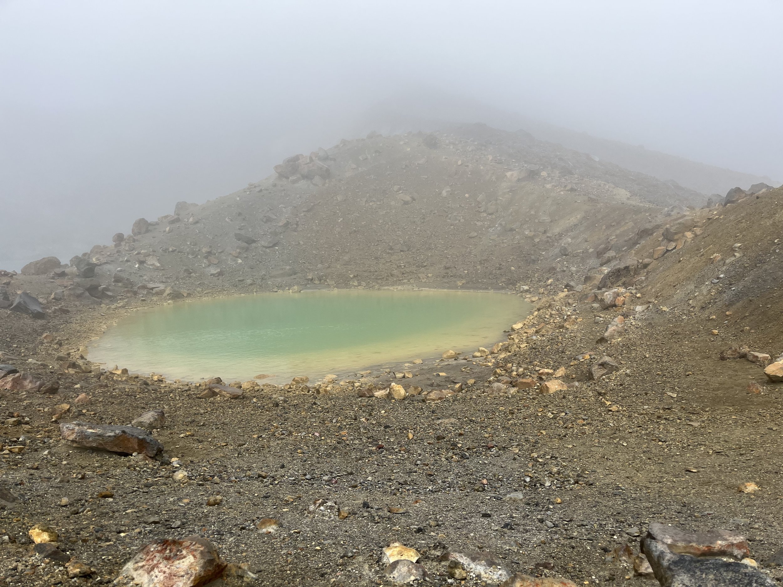
As we went higher visibility got worse as well. Soon we were in a cloud. A windy, wet cloud. It felt less like getting rained on and more like being sprayed with a hose. We still managed to make out some of the features of Tongariro, like one of the Emerald Lakes.

I couldn’t take many pictures because of the wind. Also, my hands were freezing and I didn’t want to take my gloves off to take a picture. Here is me attempting a selfie with my mittens still on, and somehow only managing to take a screenshot instead.

Once we got over the highest point of the hike, we began walking down along the rim of a crater. This was when the wind was the strongest and we were really buffeted along until we finally headed down onto a field of volcanic sand. The scenery (what we could see of it anyway) was really cool – like another planet.

By this time it was around noon and we had yet to take a break all day. We knew there was a hut towards the end of the hike and we were targeting that as a dry place to eat lunch. In my head I was imagining us having lunch in a cozy hut, with a fire going so we could dry out our gloves, and maybe even a stove so we could make tea! In reality, when we arrived around 1, it was exactly that. It was such a wonderful refuge from the elements – we stayed for two hours!

When we finally dragged ourselves out, it was raining pretty hard, but the wind was not as strong. The trail we followed down to Whakapapa took us beyond the classic Tongariro Crossing route, and once we diverged from that path, the trail quality instantly became worse. Where before there was beautifully maintained boardwalk and wide gravel paths, here there was mud, rutted out trail, and shoulder-high shrubs to brush past. It was a bit of a disappointment because we were expecting smooth sailing into town after leaving the hut. But eventually the rain stopped and we finished the day like we started it: in sunshine.

Day 50: Camp 1096 to Tongariro Holiday Park

By Elliot

Distance: 12km

I didn’t sleep well last night. I’d read recent comments about the spot we’d stayed at, and someone had mentioned some kind of rodent chewing through his tent and food bag, as well as eating half his food. We don’t keep food inside the tent, so we were safe on that front. But we store our food in our backpacks. What was to stop the mouse/rat from chewing a hole in our bags to get to our food?

I knew the rodent had arrived when I heard soft scratching around the tent. I opened my eyes and looked outside, but saw nothing. Then I looked up, and there was the mouse, a shadow moving over top of the tent. If the mouse decided to chew through our packs, there wasn’t much I could do to stop them, so in theory there was no reason to stay awake and alert the entire night. In practice, I slept fitfully and was hyper aware of all the noises outside the tent.

Luckily, when we woke up this morning, our bags and food were intact, except for a tiny nibble on the inside of Ruth’s bag.

It wasn’t raining this morning, which was much appreciated. Given the short day we had ahead of us, we waited for the sun to hit our campsite and put our clothes on the drying line.

Eventually, we started moving, and luckily our shoes didn’t get any wetter than they were already, not for lack of trying by the trail.

We had some uphills today that were really slow, as the track we were on was wet clay, and so extremely slippery.

After just over an hour and a half, we were on roads, and cruised the last 7kms into camp. Meanwhile, Tongariro and Ngauruhoe loomed over us and seemed to get closer with every step.

Day 49: Owhango to Camp 1096 (42 Traverse)

By Ruth

Distance: 28 km

Today we set off on another section of trail that we’ve been aware was coming for a while. The 42 Traverse is a “multi-use” trail through a lovely forest. It is probably most well-known as a mountain biking trail but you can also go on it with your 4x4, and it’s also used for hunting! Coming from Canada it feels a bit strange that all this is allowed on a trail maintained by the Department of Conservation.

The first 20-odd kilometres of the day were on the 4x4 track through the forest. Despite it being the weekend, it was very quiet on the trail. We only saw three mountain bikers and one friendly hunter in his pickup truck. The reason for it being quiet was probably the weather. A couple rays of sun peeked through in the morning, but it soon turned to a light drizzle or maybe a heavy mist. Weather forecasting had not predicted rain for today so we were confident that the dampness was going to be short-lived. But as the day progressed, the rain continued.

We remained in good spirits though because the rain was light and our rain gear was more than up to the task of keeping us dry. We even managed to shelter under some trees for a relatively dry lunch.

The weather also meant our views were clouded in a bit, but it was cool to see the pockets of cloud trapped in the trees. It looked a bit like home!

After most of the day of walking on what was essentially a nice gravel road, we had to turn onto a walking-only path. What this meant is that suddenly the trail was overgrown with grass and bushes. Soaking wet grass and bushes, that we had to brush past to make our way through. In short order we were soaked through. And then it started raining harder! It took us 2 fairly miserable hours to make it the last 6 kilometres to our camping spot for the night.

We are camping along the 42 Traverse at a spot recommended by other hikers. There is nothing here other than a river and a flat spot to put our tent. The last thing we had to do before arriving at this camp spot was wade across the river. Once on the other side we quickly set up our tent, shoved our bags in the vestibule, and climbed inside to take shelter from the rain, which was coming down harder than ever.

Luckily, there was a lull in the rain for long enough for me to take a refreshing dip in the river and for us to cook and eat our dinner. It really is a beautiful camping spot and I’m holding out hope that it will be nice and sunny in the morning so we can enjoy it properly!

Day 48: Taumaranui to Owhango (rest day)

By Elliot

We skipped 26km of walking on asphalt today. We got a ride from Taumaranui to Owhango.

The canoe outfitter we are using to paddle the Whanganui river in a few days met us at the supermarket in Taumaranui. The idea is that you do your grocery shop for your canoe trip, and the outfitter keeps your food until you meet them at Whakahoro, where they also bring the canoe. Since they were already coming to get our food, we asked for a ride as well. It worked perfectly!

Well, sort of. We ended up in Owhango at noon, and while there is nothing to do in Taumaranui, there is even less to do is Owhango. There is a single cafe, and we went there for tea and smoothies, but that only occupied us for half an hour. The afternoon felt like it stretched out interminably.

Luckily, it’s evening now and the sun has gone down, so we can go to bed. Good night!

Day 47: Ongarue to Taumaranui

By Elliot

Distance: 26km

I didn’t sleep so well last night. Truthfully, I rarely sleep well in the tent, but it doesn’t seem to affect my enjoyment of the day. But last night, I decided to get up and go outside to pee, which is an ordeal. And it led to a moment where I felt so lucky and happy to be on the trail. As I unzipped the tent and stepped outside, the night sky was clear and the stars bright, beautiful and numerous. I was cold, but lingered outside the tent for longer than I had to, all to enjoy the night sky.

Our walk today was quite monotonous. It started with 15km of gravel road, which changed to pavement for the last 11km. The road wasn’t ugly or too busy, but it got boring after the gravel road. It didn’t help that, for the first time in a while, it was sunny and warm all day.

The most fun we had today was seeing a few sheep that had escaped from who knows where, running away from us as we kept walking in their direction. At one point, they forgot they were trying to escape and started eating grass, before remembering that they should be running.

We are staying at a motel tonight with our own kitchen, so I made sure to cook and pack in as many veggies as possible. We also had the opportunity to use a laundry machine. Often, doing laundry means using whatever hand soap is at our disposal and trying to rub it into a garment in a sink before rinsing. With our socks, sometimes rinsing and wringing several times is not enough for the water to run clear: the mud and dirt is just that deeply embedded. So we are thankful when we get to use a laundry machine.

Day 46: Piropiro to Ongarue

By Ruth

Distance: 42 km (biking again!)

What a treat the Timber Trail has been for us! The trail is super well-maintained and goes through kilometre after kilometre of beautiful forest, punctuated by bridges over river gorges and views out over different valleys. And each day has only been a few hours of biking so we’ve had lots of long breaks and time to read and chat. It feels like the weekend!

This morning we woke up at our usual time (5:45) but we didn’t get going until 10 am – with only 42 km to bike, we didn’t need to start early. So, you may be wondering, what did we do with all that time in the morning? Well, we ate. The camping option we chose was the more “flash” choice, and came with a cook-it-yourself all-you-can-eat breakfast. Over the course of the morning today we had toast with peanut butter, more toast with scrambled eggs, and two bowls of cereal. And a cup of tea with each, of course. After that I thought I would feel over stuffed but actually I just felt good! And I wasn’t hungry again until after 1. Amazing.

Today’s ride was a bit of a climb at the start, and then basically all downhill. A lot of the trail is what used to be a tramway for logging in the forest, so none of the hills are too steep. It was overall a lot of fun. We also passed kilometre 1000 of the TA! Can’t believe we’re here already and at the same time it feels like there is still so far to go.

Tonight we are camping at the parking lot at the end of the Timber Trail. With some forested hills on one side and a sheep pasture on the other, it’s actually nicer than it sounds.

Day 45: Pureora to Piropiro

By Elliot

Distance: 40km (on a bike)

We are on the timber trail!

We’d arranged to rent bikes a few days ago, so this morning we only had to walk 500m to the start of the timber trail from our campsite to get our bikes from Paul, the guy who brought them in on the back of his van. We took lunch, snacks, and some additional layers with us in daypacks that Paul provided, gave him our big backpacks, and we were off.

Maybe some of you, my dear readers, might already know this, but it really came as a big shock to me: biking is so much faster than walking. In just over an hour, we had biked 11km. Knowing that we were only biking 40km, and not wanting the day to be over too soon, we parked our bikes and hiked to the top of a peak and back in 1.25 hours. At 1165m, this was the highest point we’ve been to so far in NZ.

After the hike and some lunch, the day was mostly downhill biking, and went by really quickly. We went over some great suspension bridges, which were over 100m off the ground in the middle. It really felt like the world dropped away from under me on those bridges.

We arrived at camp today at 3:45pm, even with our hike, and the fact that the day began leisurely at 9:30am. Our camp tonight is a glamping site where we are allowed to pitch our tents in the corner, along the tree line. Still nice though!

This evening, we started planning for our next chunk of trail. We’ve realized that there is quite a bit of road walking, and maybe we want to skip some of those parts. That being said, it feels like we will be getting to the end of the North Island soon and I worry that we are rushing the journey by skipping sections, even if they are road. Luckily, we will be walking a fair share of the day after tomorrow on paved road, so that will give me time and perspective to reassess whether to walk roads or not.

Day 44: Mangaokewa North camping to Pureora

By Ruth

Distance: 30 km

One topic that comes up a lot on the trail is food. Everyone is in search of the magical meal that is delicious, filling, and light to carry. People have different preferences amongst the three.

For us we want filling/nutritious first, lightweight second, and then within those constraints try to get as delicious as we can. Other people seem to prioritize weight over everything, like the French man we met who is “cold soaking”, i.e. he does not carry a stove, so will pour cold water on his couscous or instant mashed potatoes and eat that for dinner with some almond butter. “It’s not that bad!”, he insists.

Other people prioritize deliciousness to an inspirational degree. For the past two days we’ve been having our meal breaks with Maeve and Linda, two Australians who seem to be carrying the entire produce aisle with them: lettuce, cherry tomatoes, cucumbers, sprouts, fresh ginger and garlic, asparagus, avocados, the list goes on. We are green with envy at their meals, and also at their strength to carry all of that good stuff for so long.

One thing that almost everyone brings is cheese, but people have different ideas of what kind of cheese is best. Some like an aged cheddar which will keep well over a few days. Others like a soft cheese like Brie or Camembert which won’t sweat like hard cheeses do. (We can’t take those because of Elliot’s bad experience with Camembert on his pilgrimage, which left his bag permanently smelling of cheese.) I enjoy cream cheese so I bring Philadelphia, which is a bit different here than in North America, but still good. And of course everyone also eats Tasty cheese.

Tasty cheese is a type of cheese here in NZ. We don’t really understand what it is. People have described it anywhere from “like a strong cheddar” to “it’s just tasty!”. We don’t know what it is, but that hasn’t stopped us from consuming a lot of it while we’re here. We have to admit, in a wrap, it is rather tasty.

Today’s walk was pretty uneventful, especially after the intensity of yesterday. We woke up amongst the sheep (the campsite was surrounded by sheep paddocks), had our breakfast and tea, and headed out on the gravel road.

We walked the entire length of that road to a highway, hitched a few kilometres along that, then walked a bit more into the Pureora Forest park where we are camping tonight. Usually I find road walking boring but after yesterday I rather enjoyed the feeling of getting into a rhythm and covering some distance.

For the next two days we are biking the Timber Trail, which we looking forward to as a real change of pace.

Day 43: Te Kuiti to Mangaokewa North camping

By Elliot

Distance: 20km

After a lovely self-catered breakfast at our motel, the day began. It was raining. We walked through town, and past a statue proclaiming Te Kuiti to be the shearing capital of the world, and eventually got to the start of the trail part of our day. I wonder if shearing capital is self proclaimed. Is there some sort of mechanism or association with o asset the legitimacy of these proclamations?

The first part of the trail was through a ditch with grasses as high as our heads that were completely saturated with water. We were also next to a fence, on the other side of which was first a sawmill, and then a limeworks. We got soaked, but since our shoes were still wet from yesterday, it wasn’t too bad.

The trail eventually left the industry of the town, and continued following the river upstream. While this sounds lovely and easy in theory, in practice it was anything but. The trail undulated a lot, forcing us to climb and descend constantly. The mud was unavoidable, making slipping very easy when it was muddy clay. The alternative was mud where our feet sunk in to mid-shin. And the width of the trail was often only enough for a single foot to be on it, while also forcing us to side hill because the trail wasn’t flat.

At one point, we thought we were done with the trickiest bits of the trail. It turns out we were incorrect. It was just a brief interlude for the trail to introduce more factors into the day: blackberry thorns and thistles. So we had all of the above to contend with while also getting our legs scratched up.

All that said, we saw some beautiful bits of forest, and the trail had some parts which were lovely. It was the kind of trail that really made us feel like we were venturing on an epic quest across the country.

It took us 9h 45min to go 20km, and we were exhausted (and very hungry!) by the end of it. Luckily there are other hikers staying at tonight’s campsite who we could commiserate about the trail with.

Day 42: Waitomo to Te Kuiti

By Ruth

Distance: 17km

At this point in the trail, we have started to meet a lot of new people. Some started before us and are doing shorter days or more rest days. Most started after us and are either the elite hikers, or have been skipping more sections than us. Yesterday we got to walk a bit with Maria, who started the trail a couple weeks before we did. She has one of the best attitudes towards the trail that we have encountered so far. After retiring, she decided to give herself the gift of walking the TA. She’s not trying to get anything out of it, other than enjoyment. She has had some challenges, and she’s not going ultralight or doing huge days, but when we asked her how she was enjoying the trail, she genuinely said she has loved every minute. It’s wonderful to meet people with such a great energy on the trail.

Today was thankfully a shorter day after yesterday’s monster of a day. We were expecting rain all day, and it dutifully started raining around 7 am. Luckily we had already taken down our tent by then! We were in no rush to head out into the rain so we lingered over a coffee with some other walkers at the general store before finally dragging ourselves onto the trail around 9.

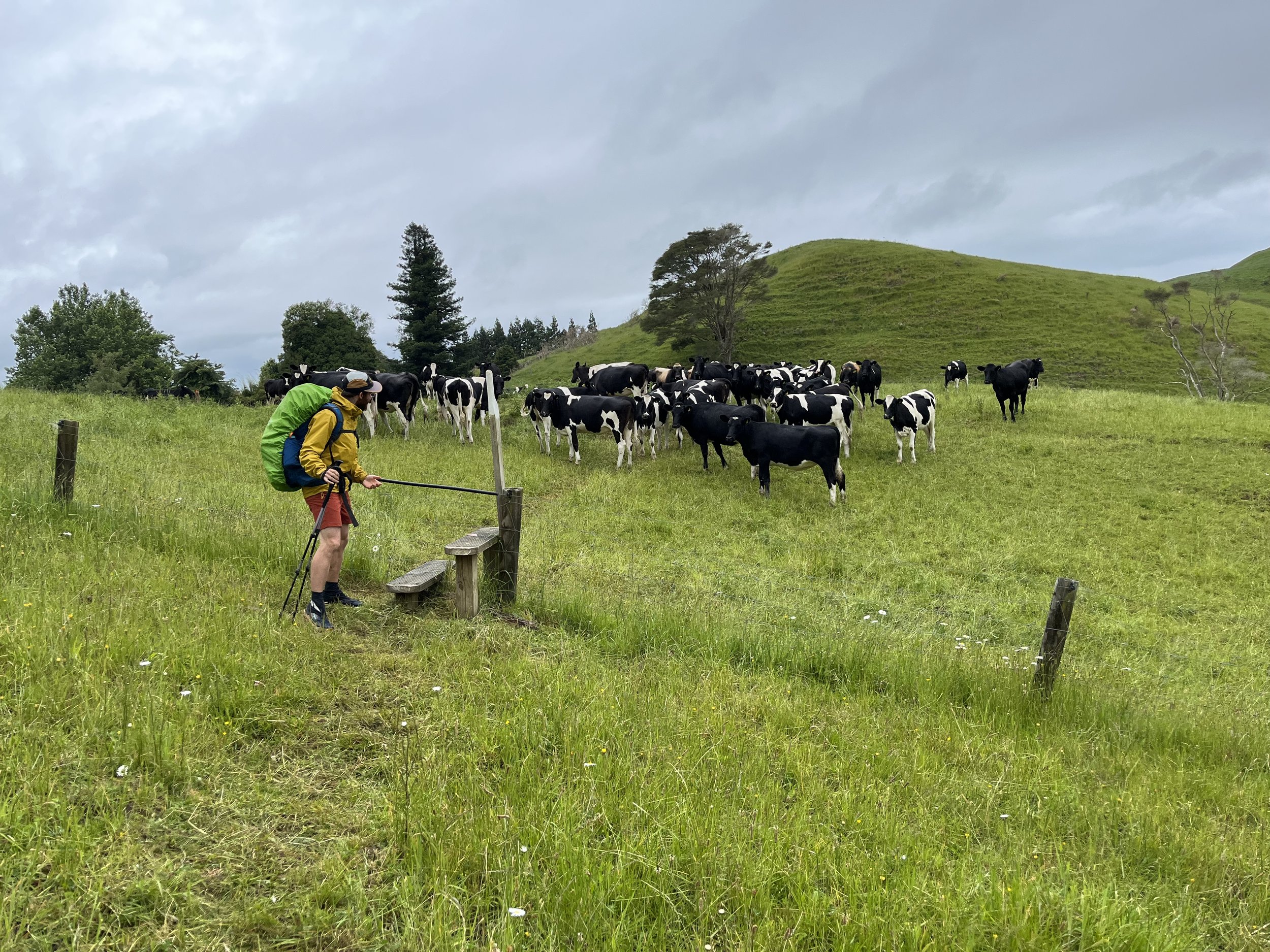
The first obstacle of the day was crossing a paddock of very curious bulls. As soon as we were over the stile, they started coming towards us. Our barely suppressed panic only mounted as we walked and we could hear them right behind us, following us across the field. When we reached the stile on the other side I nearly jumped over it.

The rest of the walk was pleasant, up and down through farm land and some cool forest with really tall trees.

After lunch some heavy clouds rolled in and it started raining in earnest, so everything became a bit less pleasant. With all the long grasses we were walking through, it was soaking wet feet for the both of us by the end of the day.

The last bit of the walk was through a park where they had both sheep and frisbee golf! A very kiwi combination.

Tonight we were going to camp at a basic campsite a few kilometres beyond the town of Te Kuiti, but with the rain we changed our plans and are happily ensconced in a dry motel in town for the night.

Day 41: Jo’s Funny Farm to Waitomo

By Elliot

Distance: 37km

It’s amazing how being on the trail makes everyday things seem like miraculous luxuries. Cotton towels seem banal, until you are mostly limited to using pack towels that do a better job smearing water around than drying you. Kettles simplify life so much, allowing tea on demand. Normal bowls, plates and cutlery elevate any meal compared to a camping mug.

Knowing that today was going to be long, we got up around 5:30am, and were on the road by 7. We were in high spirits, and were relaxed about the kilometres we needed to walk because we had given ourselves ample time. But then, 15 minutes later, I was crushed. We’d been walking in the wrong direction, and on a paved road at that. We had to turn around, and walk uphill all the way back to our accommodation, where we should have gone down the gravel track. And so our 35km day became 37km. I wanted to curl up into a ball and cry, and then skip today’s walk and hitch to our destination. But in the end I didn’t do that, which is good, because the trail was really nice.

The trail varied a lot today, going from gravel track to bush to track to forest. We crossed grass airstrips and streams, and of course, we navigated a little bit of mud. We even saw Mount Tongariro in the distance, which is exciting as we are eventually going to be walking next to it.

It took us 10h 45min to reach Waitomo, where we are staying in a holiday park, so even though we are tenting to tonight, we got to take nice hot showers.

Day 40: Pahautea Hut to Jo’s Funny Farm

By Ruth

Distance: 15km

I woke up in the hut this morning feeling somewhat less than refreshed. Although staying in a hut is a real luxury with real tables and benches, counters to cook on, bunks to sleep on, all with an incredible view – it does have one drawback and that is the snoring of your fellow hut-mates. Elliot was okay because he has mastered the art of earplugs. I’ll have to get him to teach me how to put them in properly sometime before we get to the South Island where word is there are a lot of huts. A sunset view from a hut is pretty unbeatable though.

After an early breakfast and tea in the hut, today’s walk began. It was a bit like yesterday’s walk in reverse. First we battled mud while still enjoying a mountain forest hike, then we were on the road through some pretty countryside for a couple hours.

Despite them causing me some pain over the past couple of days of walking, I was very pleased to have my new shoes keeping my feet nice and dry through some muddy trail sections. I was much faster than Elliot on the downhills today because he had to carefully pick his way around the mud while I traipsed right through it!

Overall it was an enjoyable hike down from the hut. We had heard some horror stories about the mud on this section, but since the weather has been relatively dry recently, it wasn’t so bad for us.

After the forest was a pleasant gravel road where we had views back to Mount Pirongia (which we summitted yesterday), over farmland, and even down to the coast.

One thing we weren’t expecting is that since Huntly we have needed to rely a lot more on trail angels than we did further North. For the past few days we have been out of typical tourist areas where there are hostels and holiday parks, so we’ve had to rely more on the trail angel network to find places to sleep. We’ve gotten to experience lots of different styles of trail angeling and it’s been very interesting.

Jo’s Funny Farm is probably one of the earliest trail angel spots and Jo has a great guest book and lots of stories about the TA over the years. There are over a dozen of us camping out at her place tonight and she served a great dinner with homemade cheeses, butter, and ice cream from her two cows. For me the best part of staying with angels is getting to meet and chat with them. It is a much less standard experience than staying at a campsite or holiday park, and it can be hard not knowing exactly what to expect when you arrive after a long day of walking. But it’s much more personal and interesting too, and a really cool part of the trail.